June 7, 2017
Total miles: 13.6 miles
Start: mile 775.7
End: 0.8 miles down Bullfrog Lake trail (mile 788.5)
Total elevation gain/loss: 2948.2/3695.2 ft
Today was the day — we’d be crossing Forrester Pass! People have been talking about this moment for weeks now and we’d soon have it (hopefully) behind us!
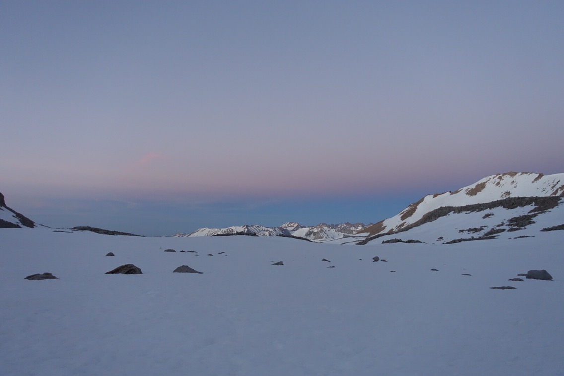
I slept surprisingly well last night given my anticipation about today’s climb. A win for Advil PM! We were up and ready to hike at 4am sharp. Sam and Tam needed a few more minutes, so we set off across the ice field knowing that they would catch up before the pass.
Navigating in the dark on a sun-cup filled ice field turned out to be a little trickier than I imagined. After a while we found ourselves a bit off trail. Luckily, course correction wasn’t difficult and we were on our way again.
As expected, Sam and Tam caught up with us just as the morning light was making our headlamps unnecessary. The progression of the morning light on the surrounding mountains was riveting:

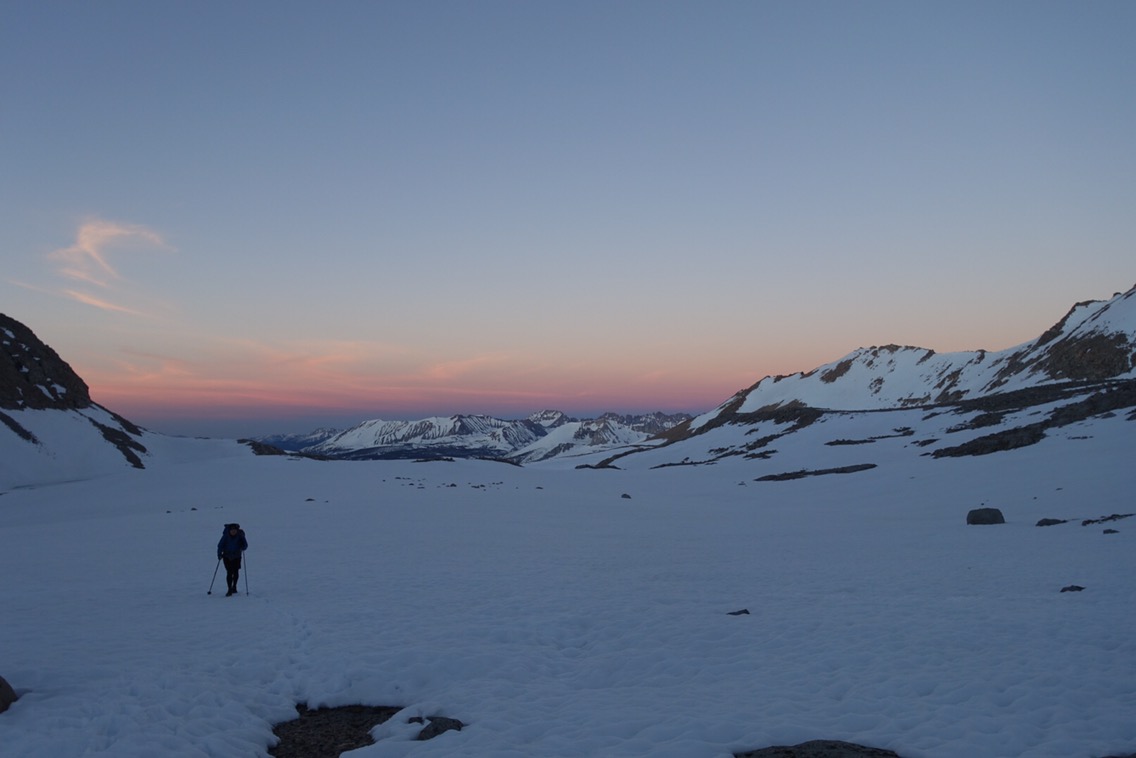
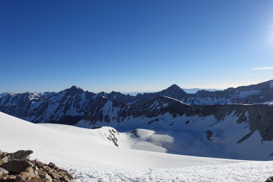
We made good time and the snow was still firm as we approached the pass itself. It rose up steeply from the snow field.
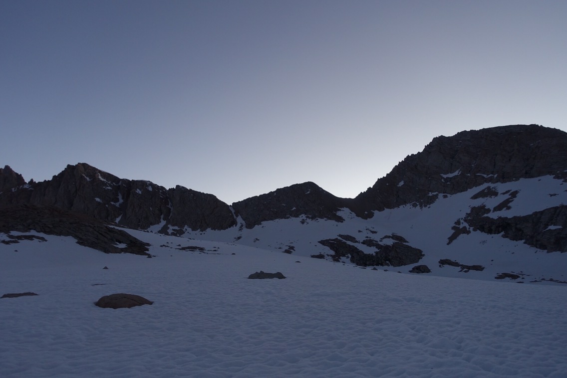
The pass is at the ‘v’ in the center (left).

More great morning light.

Looking up the switchbacks. Best not to look down.
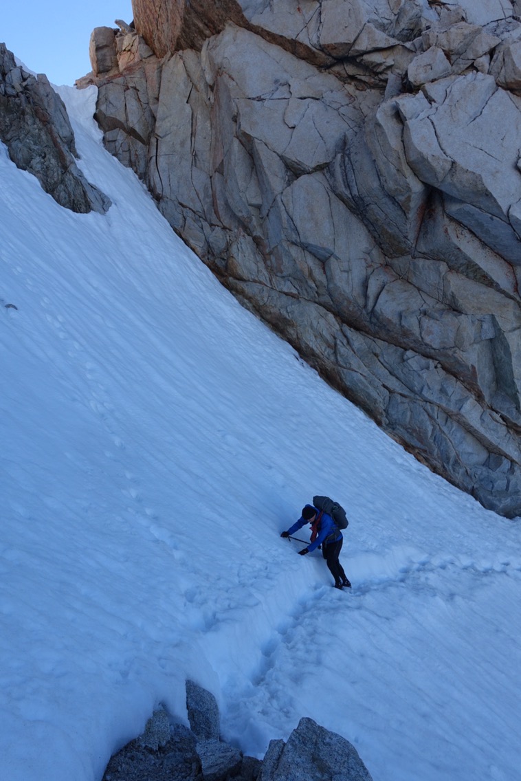
Finally, we reached the exposed switchbacks higher up. I threw my poles onto the switchbacks and climbed up and over the rocks to get up on them. Solid ground! Walking on dirt, the path was easy.
And then I arrived at the ice chute. The chute is part of PCT legend, especially in big snow years, namely because it is a narrow ribbon of trail across a very steep section of snow and ice. A misstep could be deadly. I waited for the whole group to arrive, and then we crossed one at a time. I stowed my second pole in my pack and used the head of the whippet to anchor into the wall before each step. I crossed slowly. Honestly, it was easier than I thought it would be. Probably because others have gone before us and cleared the path. Sometimes it doesn’t pay to be a trail blazer.

Having crossed the chute, we were almost to the top of Forrester Pass — the highest point on the PCT. We’d heard that there was a 5-10 foot snow cornice that we’d have to climb over as a final challenge. But there was no snow, just solid dirt trail with a tiny bit of snow at the top. I guess a lot of snow has melted in the last week!

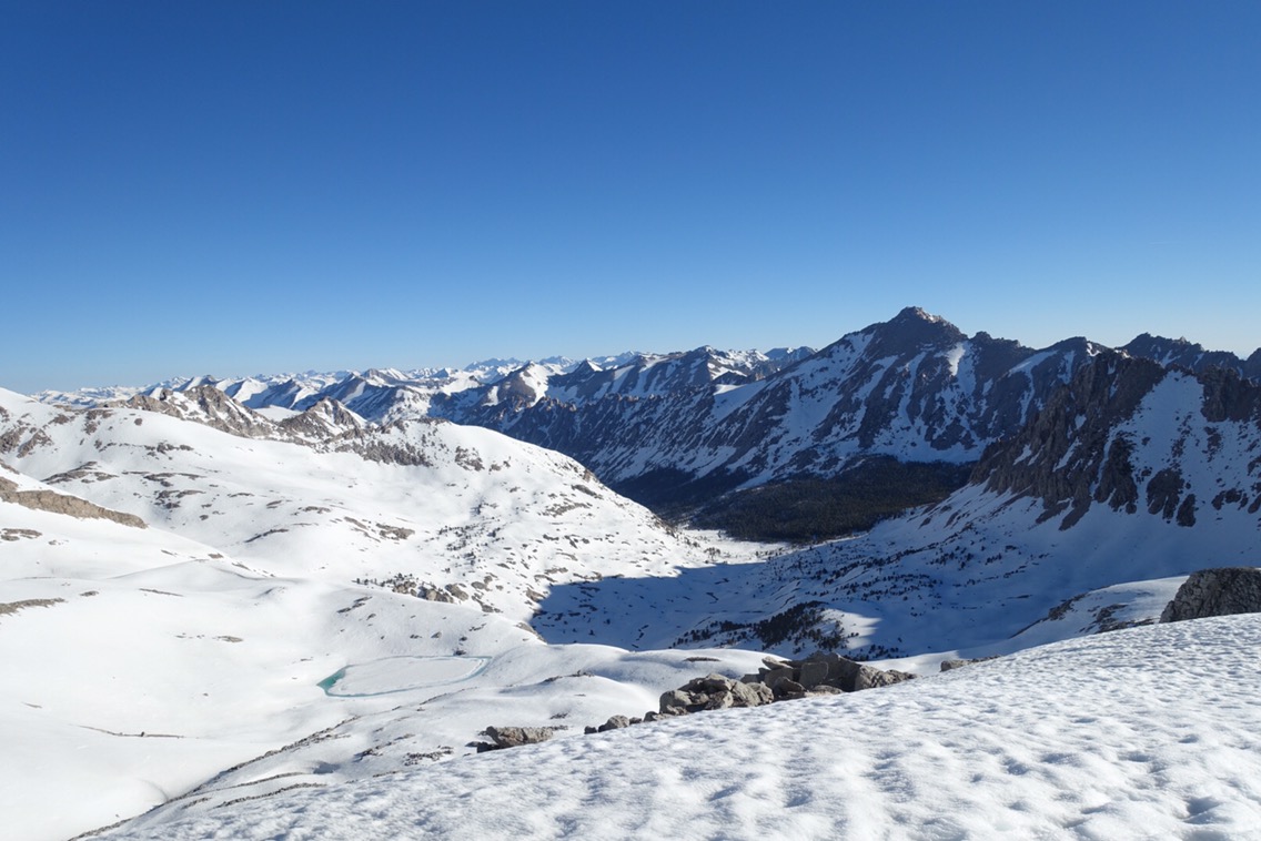
 Looking south from the pass.
Looking north from the pass.
We took the obligatory pictures at the top of the pass and then headed down. It wasn’t yet 7:00 a.m. and the snow was still hard. Following the tracks of those that had glissaded down the mountain would not be an option for us (if the snow isn’t soft enough it is really painful and dangerous).

Looking back up at the pass.
We walked along some existing footprints. This time the prints were so deep from postholing that it was easier to walk next to them in the slope than in them. After awhile, we even came across some dirt trail (for a minute). We picked our course carefully to make sure that it wasn’t too steep. At one point we even managed to fit in a short glissade.


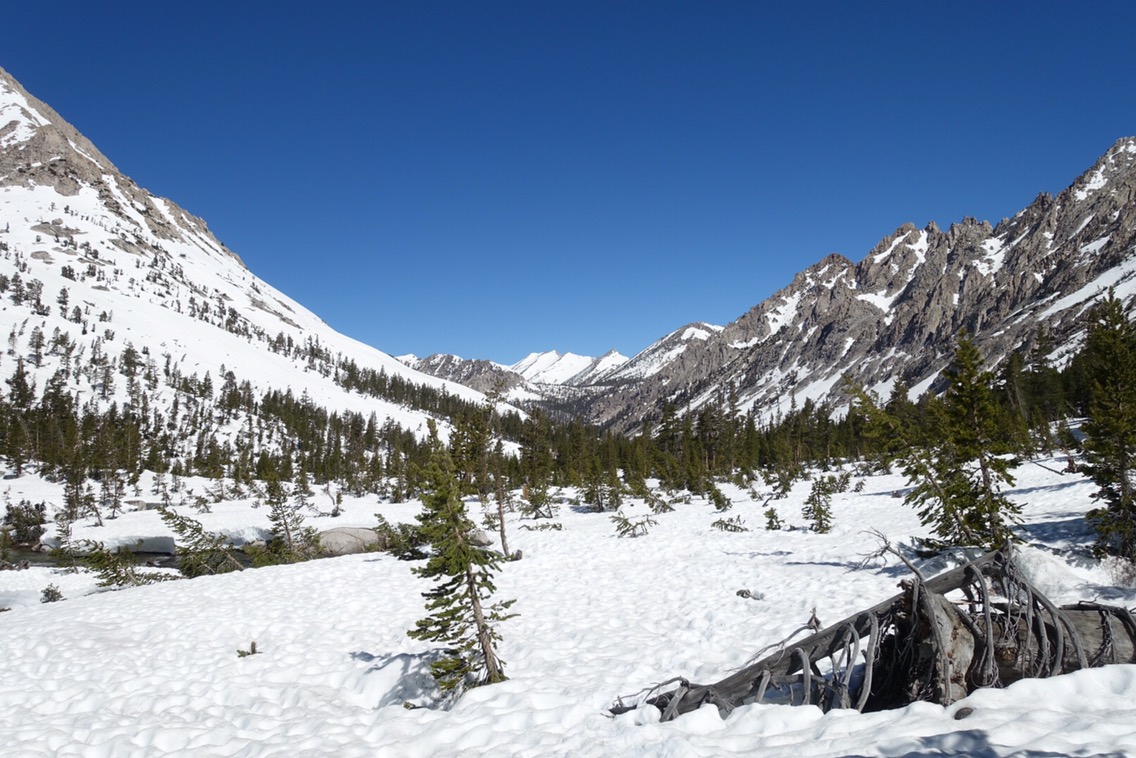
The rest of the morning was spent making our way down the mountain along Bubbs Creek, which we thankfully didn’t have to cross. While the trail was technically in a steady descent, we spent a lot of time hiking up and down the snow banks around the trees. It looks like trail crews may have their work cut out for them here because we saw a ton of blow downs.

As we descended further, the ground became more and more wet and there were numerous little stream crossings. We were pretty much able to jump, rock hop, or take snow bridges across most of the streams. There was one that we had to get our feet wet for, but it was an easy calf-high crossing. Nothing like yesterday’s drama!
We stopped for lunch in Vidette Meadow, the low point of today’s trail, and then started climbing back up. Our goal for the day was to camp near the Kearsarge Pass trail junction, which would mean a nice early afternoon stop for us. We were treated to some dry trail before we were back to scrambling in the snow. At one point we climbed up a large snowy hill only to have to rock scramble to get back to the trail.


As the day became later the snow became softer. I slipped a couple times, one of which hurt my back again. Hopefully nothing that a couple ibuprofen won’t fix though.
The camping area less than a half mile before the turnoff was completely covered in snow. The same was true at the trail crossing. The snow was so high we didn’t even see a trail junction sign! None of the trees had enough dry ground around them to camp. Our options were to camp on the snow or keep going (up). Weighing those choices we kept going. I really didn’t want to keep walking in the soft, mushy snow, but I also didn’t want to camp on it.

No dry camping here…
We continued to scout out the trees as we walked out on the Bullfrog Lake trail toward Kearsarge Pass, but none of them had dry space for a tent. We decided as a group that we’d go around to the back of Bullfrog Lake, and if there wasn’t anything there we’d camp on the snow. After that the trail would climb too much to make finding anything likely.
We scouted out some rocky outcrops on the backside of the lake. Sure enough, we found two spots! We wouldn’t have to camp directly on the snow! Just right next to it!
I’m exhausted. I know that the others are excited to go into town tomorrow, but I’m honestly ambivalent. I like it out here in the Sierra. Despite the moments when things seem difficult or risky there are a lot of awe-inspiring and peaceful moments. I like the quiet and the feeling of being disconnected. Plus, we brought way too much food on this segment, so I’m not particularly hungry. Or maybe that’s why we have too much food? That and our habit of walking while eating our bars doesn’t work in the snow.
Tomorrow we finish going up and over Kearsarge Pass. We’ll sleep in a little (starting hiking at 5:30) and hopefully still get into Independence and then Bishop at a good time. I guess I won’t mind a shower and some laundry — things are getting a bit depressing on that front!
Current ailments:
Elizabeth: sore back.
Michael: sore knees.

Yeah Forrester! The steepness of that chute is difficult to document in photos, but I know it is intense.
LikeLiked by 1 person
I have to admit, the river crossings scared me more than Forrester! Still really awesome to go over Forrester in those conditions!
LikeLike
The early morning light photos are beautiful. Honestly, I was getting sweaty palms reading this as you approached the ice chute until you said it was easier than you expected. Whew! Good job!
LikeLiked by 1 person
Thanks! It’s nice to have Forrester behind us now!
LikeLiked by 1 person
this looks crazy!
LikeLiked by 1 person
Pingback: Day 109: Finishing the Mt. Jefferson Reroute | two backpacks, no plan