August 17, 2017
Total daily miles: 26.4 miles
Total PCT miles: 1944.8
Start: mile 2325.3
End: mile 2351.7
Total elevation gain/loss: 3448.5/4677.5 ft
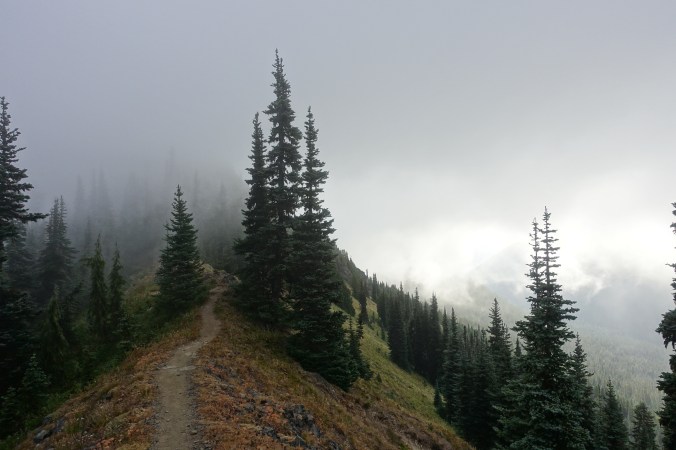
When we woke up this morning, the impressive views that had surrounded us when we went to sleep had disappeared. We were now in the clouds. The trail was barely visible in the distance as it wrapped around the mountain. Unsurprisingly, it was also cold. I set off once again wearing my rain jacket, beanie, buff, and even gloves to start the day.
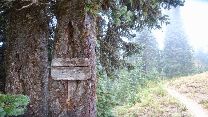
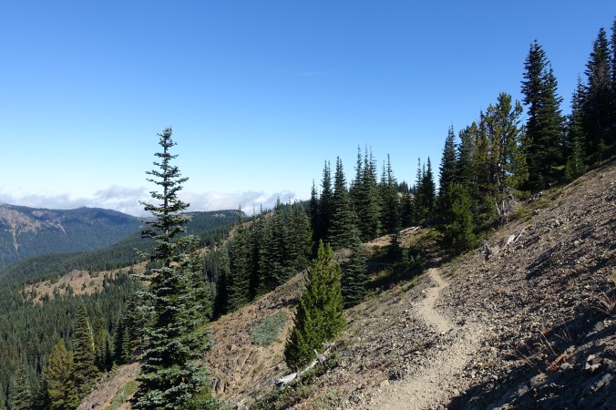
Fog City Trail — aptly named and a reminder of home (San Francisco’s nickname is Fog City).
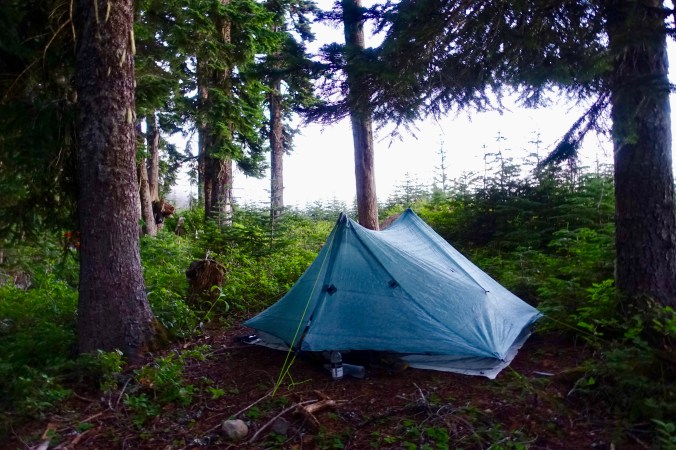
About a mile down trail we reached the trail junction that we could have pushed to for camping last night. As we approached, I saw that there was a tent set up there and was relieved that we’d stopped when we did. I was even happier with my decision when I saw that the tent and hiker packing up next to it were soaking wet. The trees hanging over the tent had transformed the heavy fog to rain! I guess we got off easy with only minor condensation.
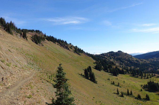
We stayed socked in by the clouds for the next couple of hours. I’m sure that this section would have great views, but we missed them entirely. The fog was too thick. Every time I thought that we might be emerging from the clouds, we went over a saddle and we’re smack dab back in the middle of the clouds. Finally, the clouds lifted and we could see into the distance.
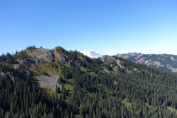
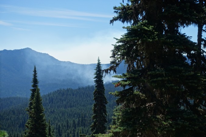
What we saw was smoke. The wildfire was close enough that we could more or less see the specific point that the smoke was rising from, but we were too far to see the flames. The smoke seemed far enough away that we could take the time to treat water from a spring, but close enough that we knew we should keep up a good pace until we put more distance between us and the smoke. And then the trail turned and started to head straight for the smoke.

Smoke! Directly ahead…
My thoughts were instantly filled with memories of the Jefferson fire. Would we have to turn around? Exit on a side trail? Could we skip through in time? Didn’t they realize that there are hikers out here? Did they closed the trail and that’s why I hadn’t seen anyone this morning? I kept hoping that the trail would turn, but I couldn’t tell from my map if it would turn enough. It looked like we’d practically run into the smoke if the trail continued on its current trajectory down the valley.
And then, finally, the trail veered to the left. We climbed up behind a hill, putting a ridge line between us and the fire. I started to breathe more deeply. I passed a southbounder (first of the day!) and felt better that the trail apparently hadn’t been closed. I wouldn’t be surprised if this fire eventually crosses the PCT, but we made it through.
After turning away from the fire, we could see it briefly behind us when we came up to a ridge line. I’m so grateful the trial made that turn to the left!
For lunch we stopped alongside a small creek and tried to absorb some sunlight. It was such a chilly morning and I still found it too cold to comfortably sit in the shade without a jacket. As we ate lunch, we talked about how few people we’d seen so far today. Just the soaking wet guy and the one sobo hiker. After days filled with day hikers, weekend backpackers, section hikers, and sobos, we felt eerily alone. No one passed as we ate at one of the few water sources of the day. In Southern California this is precisely where we would have seen people, but not today.

We’d hiked more than 14 miles by lunchtime, so our afternoon was fairly relaxed. It was back into the trees for a while as we hiked down and then up and then down again to reach the Mike Urich cabin. I powered along thinking that surely there would be people at the cabin — maybe some locals or other hikers… maybe trail magic.

As with the rest of the day, the cabin was deserted. It seemed much nicer than I had expected, but I guess my expectations are pretty low after many of the rundown shelters we’ve seen on trail. Not that I’d probably opt to sleep inside unless it was raining, but that’s also because my tent is basically my home now. A moot point today since we weren’t even at 20 miles yet, so stopping at the cabin wasn’t an option. I signed the log book, taking note of who is ahead of us, and then we were off.
The next several miles were unremarkable save for the fact that we actually saw a few more hikers heading south! My interaction with one of them cracked me up and was a good reminder of the difference between nobo and sobo hikers at this point (or maybe he was a section hiker?). We were hiking through an old burn zone and I commented to the other hiker about “another burn zone.” He responded, “oh, is this what it looks like after a forest fire?” He hadn’t seen one before. Granted, this was from an old fire, but I couldn’t help but shake my head with amazement after he passed. I’ve spent countless days in burn zones at this point… here’s to hoping his lack of familiarity means there are few to come until Canada!


I love the idea of a sign explaining the origin of a burn zone. It gave a lot of context for what a 19-year-fire looks like.
Once again, we were faced with a gap in camping options this evening. We could stop early at about 26.4 miles (we made good time today), or we could push further and hope to find something before the next campsite listed in Guthooks at the 31.5 mile point for our day. I didn’t spot many camp site opportunities early this morning in the gap we faced last night and the topo map didn’t look encouraging for the gap tonight. An early night it would be.
We grabbed water a couple miles before our intended spot and ended up walking until about 6pm. There was already one woman here, and the remaining spot is a bit slanted, but I guess it was better than hiking another 5+ miles today. We do have a nice view of the nearby mountains. Our site is near a dirt road, and a couple of trucks have passed (one seemed lost and turned around), but I think it’s unlikely that there will be overnight traffic and we have some protection from the bushes surrounding our site.
 Camping away from water means another bug free night and eating outside. We tried to hang out some clothes to dry during the evening, but with the cool, moist Washington air we didn’t have much success. My main concern is that the ground seems damp. I have my fingers crossed that we aren’t subject to tree rain tonight!
Because of our early stop, we still have 41 miles left to cover over the next day and a half until we briefly get off trail at Snoqualmie pass to see the eclipse. Not ideal, but hopefully doable if we can fit in another 25+ mile day.
Current ailments:
Elizabeth: none, my insole seems to have cooperated today. Maybe the problem has passed?
Michael: pain.
