by Michael
As regular readers know, we like hiking. Leave us somewhere too long and we find the trails. One of the draws that led us to visit Hong Kong was the allure of lots of easy to access hiking trails and we had looked into the 100 kilometer MacLehose Trail but figured it would was too long for us to do without our full camping gear. The trail runs east-west across the Kowloon Peninsula, with view of islands, ports and cities.

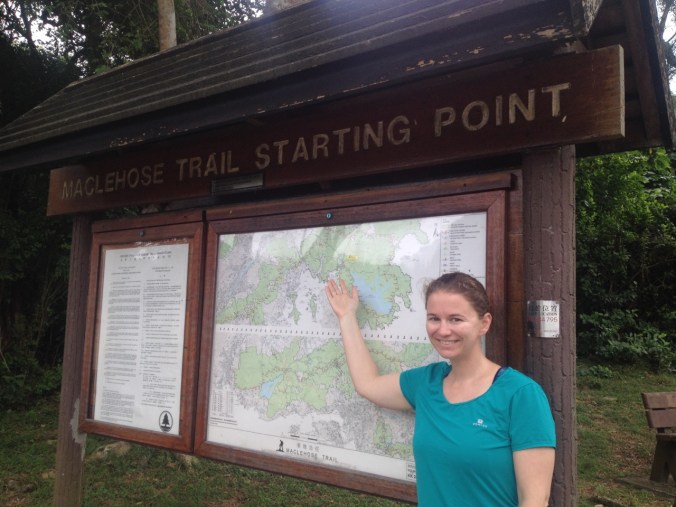
The trail is officially divided into 10 stages, although not all stages are created equal. We initially set out to only hike stages 1 and 2, and maybe stage 3. While on the first stage, we talked about our schedule and decided that it would work for us to take four days and hike the whole trail. Not having a tent, we would spend all nights in our hotel room(s) in Kowloon, near the Jordan Road MTR station — the downtown-ish area with the cheapest rooms in Hong Kong. We managed to piece together the full trail using transit (and one taxi) to shuttle us back and forth.
Hiking is a great way to see Hong Kong for what it is — dense city and beautiful countryside, with mountains and valleys, islands and coves. The MacLehose Trail makes you work by gaining and dropping a lot of elevation, but it rewards hikers with a variety of superb views.
There is good information on the government website about each stage of the trail, which you can read here. However, that website doesn’t help figure out how to break the trail into days. We broke it into four days, which works for us as regular hikers. Our split was Stages 1 and 2 on day 1, Stages 3 and 4 plus a little bit of Stage 5 on day 2 (bringing us to the 50 km mark), Stages 5-8 on day 3, and Stages 9 & 10 on an easy day 4.
Distance runners could do the whole trail in less (there is a 100 km trail race on the route at least once a year); casual hikers might want to add a day or two. The main challenge is making sure that you plan to start and end each day at a point that is transit accessible. While the trail is divided into stages, some of these points can only be accessed by hiking all or part of the prior stage and are not otherwise marked or apparent on the trail.
As you hike, it’s easy to track your progress with signs that show how far you have gone. The signs are placed every 1/2 kilometer, so just divide the number by two to find your net distance (or 100 minus the number if hiking West to East). The signs also provided helpful reassurance that we were still on the correct trail. Although much of the trail is well marked, there were a number of intersections with minimal signage or signage that pointed to an intermediate point and did not explicitly mention the MacLehose Trail. We hiked without paper maps, instead relying on the descriptions from the government website linked above (that we downloaded to our phones ahead of time) and maps.me (which shows where all of the mile markers are located (so helpful!).
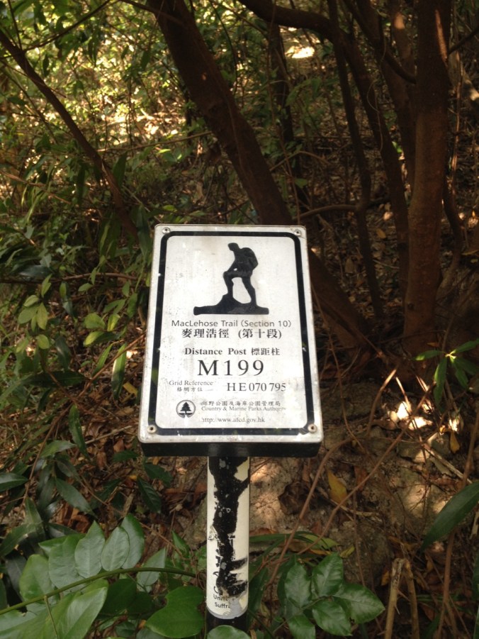
We couldn’t find the 200 marker, so this one was the last one for us.
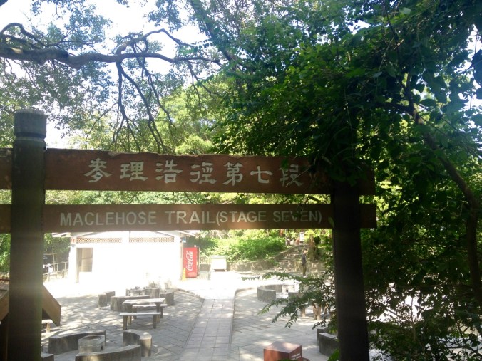
Stages 1 and 2: Reservoir, Beaches, and Mountains
Over an hour on transit (beginning with MTR (subway) to Choi Hung station, then Green Minibus 1A to Sai Kung town, and finally double-decker bus 94*) took us to the trailhead. Figuring this out gave us a later than ideal start on day one.
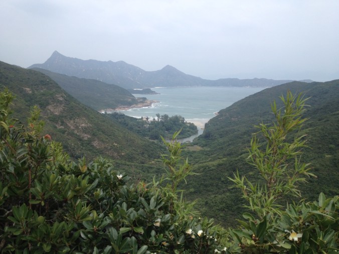
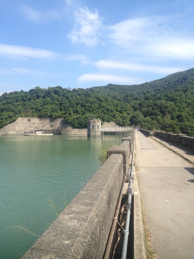
From there, segment one has beautiful views along an easy road walk. The reservoir on the left used to be an inlet from the sea. A few runners passed us as we made our way, at a good pace, to the end of the stage.
*The 92 double-decker bus runs a similar route as the 1A, also leaving from Choi Hung station, but takes much longer. A minibus — I think the 7A — runs a similar route to the 94, but it appeared to never leave the bus depot in Sai Kung. To get to the 1A bus, take exit C1. The line is long, but minibuses come every few minutes. From Sai Kung town, bus 94 leaves every half hour on weekdays. The stop for the starting point is right after the pull-in parking lot where lots of other hikers get off.
Hike starts here.

This is in the reservoir. I think a Bond villain is using it as a hideout.

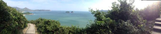
View of the sea from the road.
The vast majority of stage one is along a paved road and is fairly level. The trail isn’t exciting, but the views are great! The official end of the stage (and beginning of stage two) is just past the end of the road and is only accessible via the trail, which we found a confusing decision by the trail’s creators (though it didn’t matter much since we were set on hiking multiple stages). At that point we thought we might be able to hike three stages in the day — we had to cancel that plan because the up and down of stage two slowed down our walking pace.
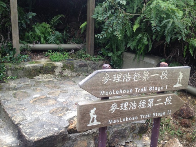
Where the segments meet there are signs.
Our first serious ascent of stage two was tiring. Part way up, we stopped at a small gazebo to eat some smacks. Bees found us and followed us up the trail toward the summit. Eventually we made it down the other side and the bees left us alone. Along the shore, two villages (Sai Wan, on the trail, and Ham Tin, slightly off trail) offer cooked meals. These ended up being the only places along the entire trail where one could stop for lunch (luckily we packed lunches and snacks each day). We ate at Sai Wan, then hurried along our way with the goal of finishing stage 3 in the same day. By the time we were near Ham Tin, we knew we would need to delay stage 3, so we stopped for a cold soda and a walk on a ramshackle bridge at Ham Tin.
Except for a few short segments, the whole trail was paved — either paved road, cement trail, or stone steps.
Looking at an inlet.
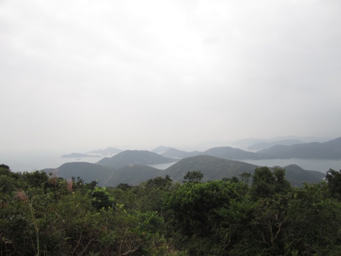
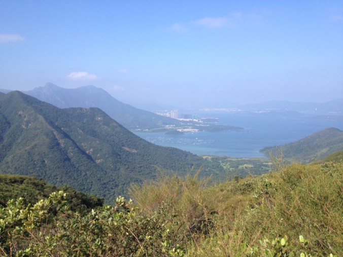
Islands and mountains through the haze.
Going downhill toward the beach.
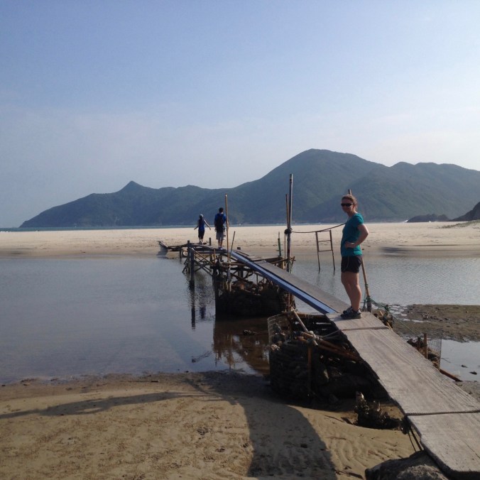
Not the best bridge . . .
We finished the stage after another up and down took us back to the road where we caught the same bus (#94) we took in the morning (just a few stops later). While stage one was a fairly easy walk, stage two made up for it with several steep up and downs. It appears that the gentle switch-back is not favored here. The trail instead tackled the hills by going straight up and down via long, sweat-inducing stone staircases.
That evening, we walked along the waterfront in Sai Kung, looking at the seafood restaurants but being stinky from our hike, we returned to our hotel. We did find an “American Grocery” store, where we bought granola bars and a box of Kraft Macaroni & Cheese. The granola bars were good for hiking. I finally cooked the Mac n Cheese five weeks later at our hostel in Phuket, Thailand (our first opportunity). Sometimes you just crave the comfort foods from home.
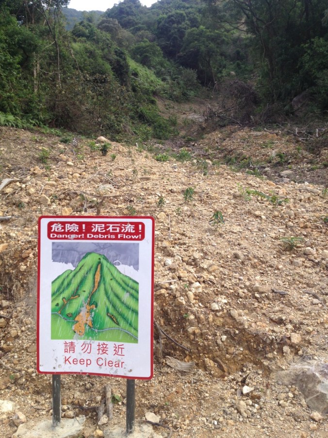
This debris flow was cleared from the path, but clearly could flow again.
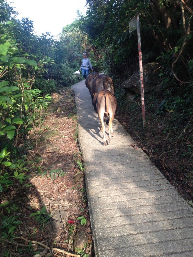
Share the path with cows.
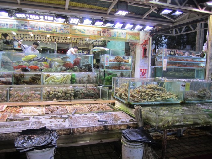
Fresh seafood in Sai Kung.
To get back to the MTR, we took the 92 double-decker bus rather than the A1 minibus. This was probably a bad choice, though the bigger problem was traffic. Eventually we got out and walked to the MTR station.
Stages 3, 4, and part of 5: First views of the city (and of monkeys)
Due to poor planning, we had to switch hotels early in the morning before our second hiking day. We tried to communicate that we just wanted to leave our bags at the new hotel, but they insisted that we wait as they prepared the room. The emphasis on hospitality was nice, even if it delayed us.
We took the same bus set-up on the morning of day two as we did the prior morning except we took the 92 double-decker rather the 1A minibus to get to Sai Kung. This also delayed us and we had just enough time for Elizabeth to run to Subway to pick up sandwiches for lunch before our next bus to the trailhead left. But we did finally made it out to start on Stage 3:
The arrow points flat. Not pictured: path going up.
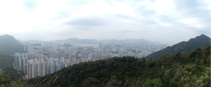
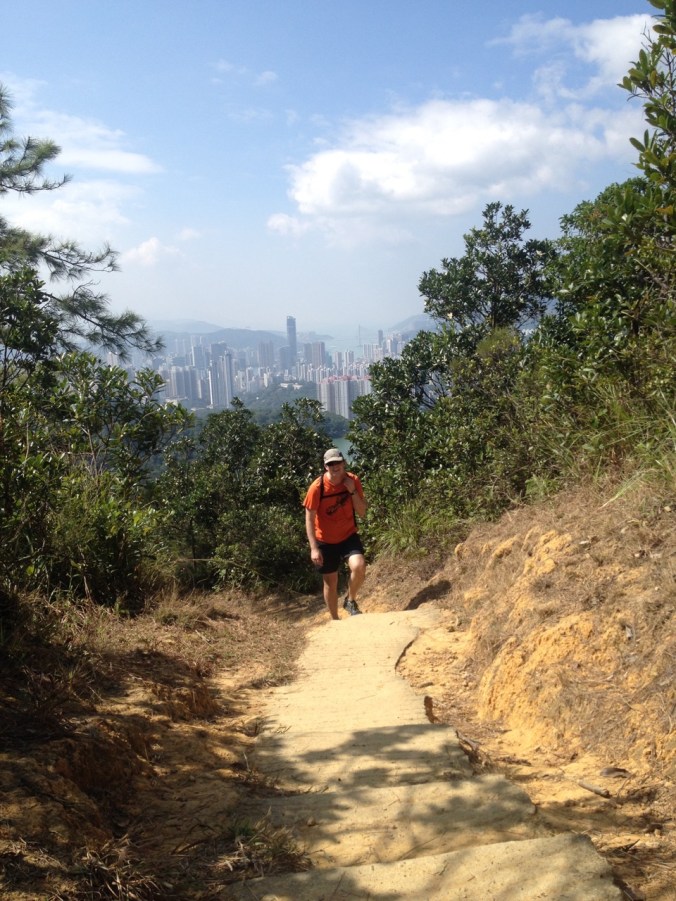
We quickly started ascending steep slopes, usually up steps. The route runs up the hills, then along some hilltops to views that overlook the shoreline. Unlike day 1, there were primarily dirt trails (the sections on day 1 are very popular, so were likely paved to handle the high-use impact). Like day 1, there was a lot of challenging ups and downs.
Up the stairs!
Looking North (we’re on a peninsula so there’s water almost everywhere).
Heading down the trail.
Stage 3 crossed several other trails, and we crossed paths with many hikers on our trail and others. Eventually we reached the junction with Stage 4, where we found a vending machine with soda and a drink called Aquarius (we think it is like Gatorade). The vending machine was an awesome find since there aren’t potable water sources along the trail and it was a hot day. Of course, since it’s Hong Kong, we were able to pay using our awesome Octopus cards! Then we started Stage 4, which was much more exposed.

That way!
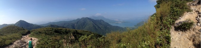
Hiking along the ridge.
Ridge trail with view. Watch your feet so you don’t fall.
Eventually we reached a grassy hilltop with people relaxing. We looked around and realized we were now directly up above Sai Kung — the town where we had started the day.
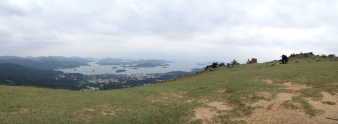
The row of seafood restaurants is down there somewhere.
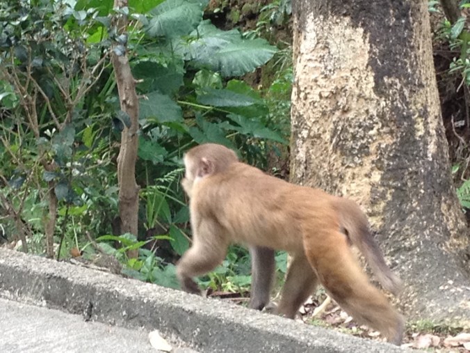
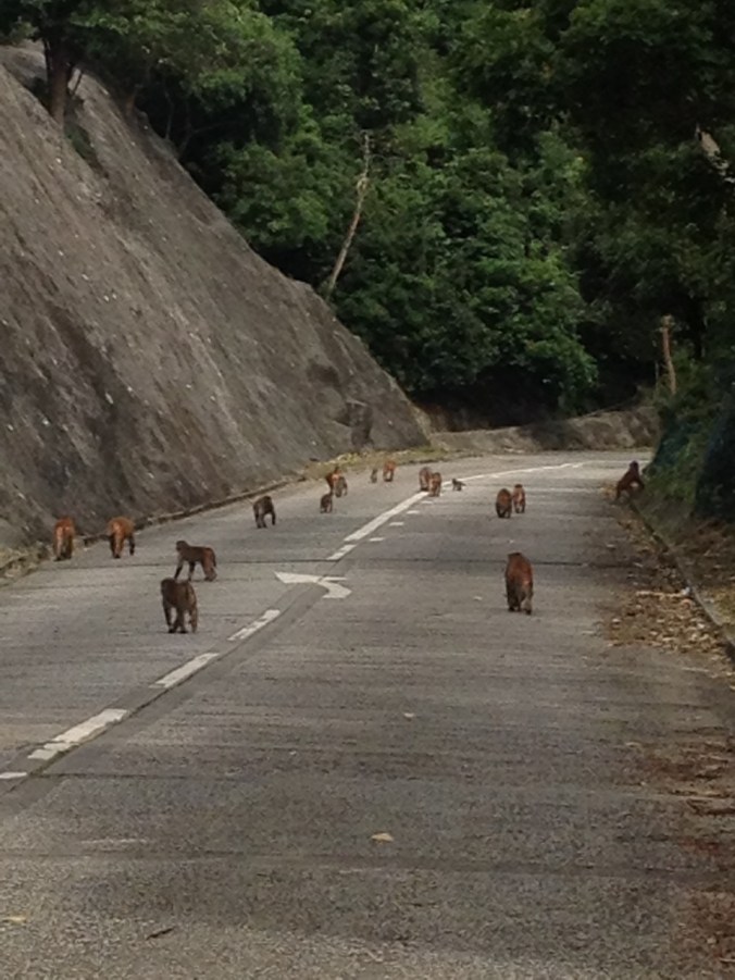
Stage 4 ends at a somewhat inconvenient location for transit, but is just up a steep hill from the urbanized part of Hong Kong. Knowing this, we had planned to continue part way through Stage 5 to Sha Tin Pass (about the 50 km mark), near the neighborhood of Tze Wan Shan. There we had our first encounter with monkeys, who we had been warned might try to steal our food. We avoided getting close to them, and left the trail and made our way down a long series of steps and road walks to the neighborhood below. We took a minibus to the Tze Wan Shan MTR station (I forgot the minibus number, but there are a ton of them) and then back to our neighborhood.
View from the trail.
Stages 5, 6, 7 & 8: The highest point in Hong Kong (Almost)
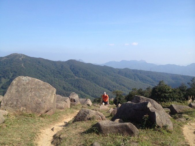
Given our long walk down from the trail to transit the night before and wanting to get an early start, we took a taxi from the Tze Wan Shan MTR station to our starting point on the trail. Our route along stage 5 was shortened because we hiked part of it the day before, while Stages 6 and 7 are short and relatively flat. So we planned to make it through Stage 8, which climbs the tallest mountain in Hong Kong.
The day started with a great view.
Right away, there were monkeys. When we wanted to snack, we had to make sure they were far away.
Stage 6 and the beginning of Stage 7 took us past a couple reservoirs, and while we were close to the city, we never walked past shops. The “eat in towns” option is a day 1 option only. It’s a good thing we picked up sandwiches at 7-11 this morning. There was a vending machine at the beginning of stage 7 where we were able to purchase a Coke and more water, but sadly no vending machine at the start of stage 8 where we stopped to eat lunch in a little pavilion next to the bathrooms (we had a hard time figuring out ahead of time where there would be vending machines or potable water).

Water. Hong Kong consumes a lot of it, so it has a complex reservoir system.
By the way, did I mention it’s illegal to feed the monkeys? Well, we followed the law, but some locals didn’t, and a lot of monkeys noticed.
Walk a route through them? Uh, ok.
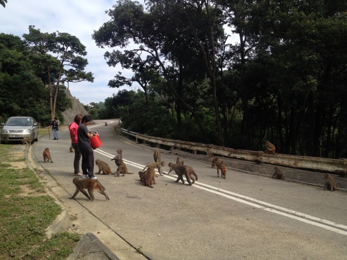
Don’t feed the monkeys. Unless you’re going to bring a giant bucket of food, then go for it…
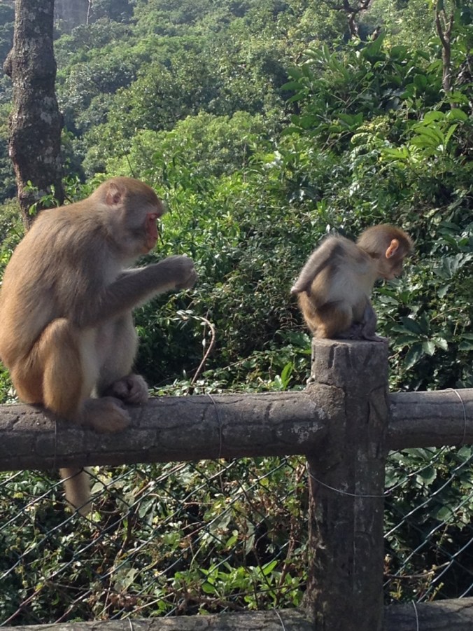
Cute baby monkey with inattentive parent monkey.
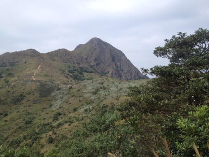
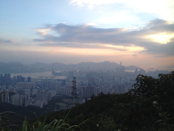
Shortly after the monkeys, we got our first view of the summit we would hike later in the day. It looked far away.

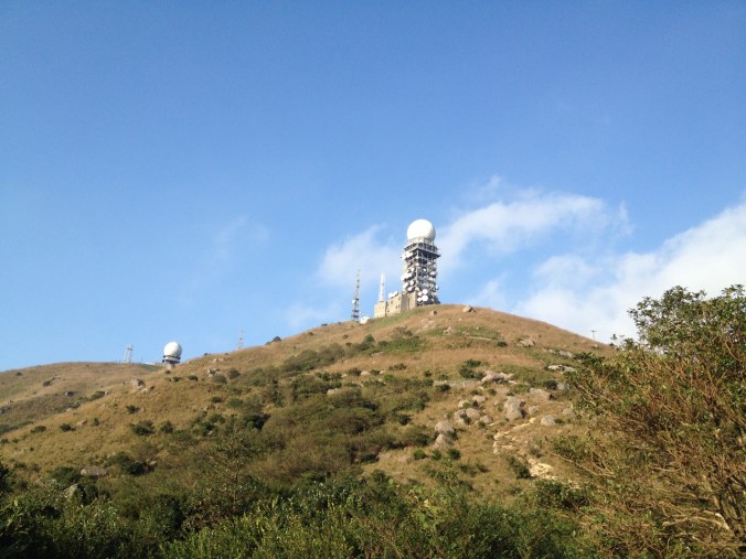
Tallest point in Hong Kong.
We also saw some World War II era bunkers. Hong Kong was attacked simultaneously with the attacks on Pearl Harbor and the Philippines. Due to the isolated position, it was not able to hold out long, and was occupied by the Japanese until the end of the war.
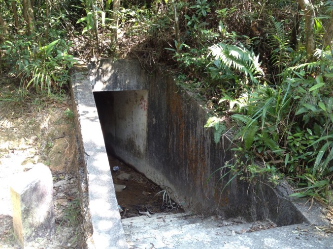
Old bunker.
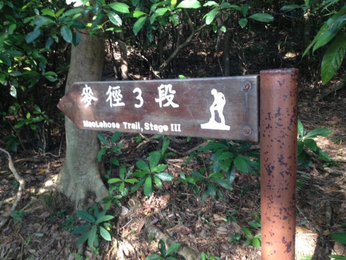
New style of sign.
More reservoir.
Me hiking with the city behind me. Did I mention that it was hot?


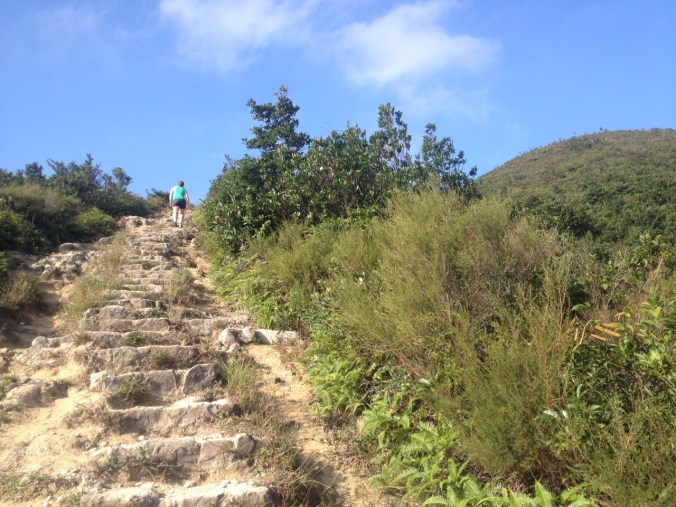
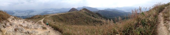
More uphill
We climbed up first trail and then road to Tai Mo Shan — the top of Hong Kong — over 900 meters high. Well, not quite to the top. The top is a fenced-off weather station, so we went as far as we could go outside the gate.

No photography of this sign allowed.
From further down the hill.
Then we made our way down to another road, another bus that picks up right at the end of stage 8 (the 80, which arrives once an hour, so we waited 40 minutes), and the MTR from Tsuen Wan station (the end of the red line) back to our hotel.
Stages 9 and 10: An Easy Finish
While the split of stages before this point was relatively equal, it left a shorter and easier final day. Once again, new and different trail signs:

There were long segments of road walking, no monkeys, and some nice views. Plus a shrine. It was not our favorite day on the trail — probably because so much of the day felt like a road walk.


But the strange part is the end. The trail dumped us at a construction site along a busy road with a sad little sign. No “Congratulations you made it.” No big gateway. Just the side of a road. Before we knew it, we were done with the trail and hopping in a random minibus that passed by with the location “Jordan Road” posted in the window (we were staying near Jordan Road) to take the above ground route back to our place.
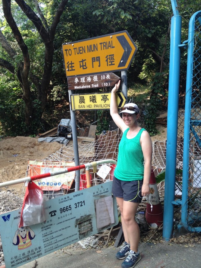
Elizabeth with the end of trail sign.
Actual end of trail.
Hiking the full MacLehose trail was a fun way for us to spend four days in Hong Kong. The trail was actually more difficult than we had imagined it would be — it felt like we were on a stairmaster (in a sauna) for sections — but that just means that we got a better workout and had to work for the amazing views! It’s fairly unusual for a trail of this length to have easy transit connections, so that was a nice treat. That said, the transit took up a lot of time each day (up to 2 hours each way) and the sun went down pretty early (5:30pm was the latest we wanted to be caught hiking), so we had less hiking time each day than we would if we were camping. The trail does offer first come, first serve camping in designated locations, but we didn’t have our gear with us so that wasn’t an option. If you find yourself with available daytime in Hong Kong, I highly recommend this hike — especially the early stages.
[This post describes our hike along the MacLehose trail in Hong Kong on November 1-4, 2016.]

Pingback: Hong Kong City | two backpacks, no plan
Pingback: How to Hike Hong Kong's MacLehose Trail: Sections 1-4 | Crawford Creations
Hi there! Thank you for the large and detailed post! I am planning to hike the trail in 5 days next week.
Im just wondering if its easy wildcamping in general? F.e. after section 3 until 7 there are no official campgrounds so im wondering if there is enough places to wildcamp? Could i camp at the shelters?.
Good to know there is water at every start of a new section!
Kelly
LikeLike