Soça Valley Hiking

by Elizabeth

Next stop in Slovenia was the Soça Valley, which is known for its beautiful mountains and roaring river.  We decided to base ourselves for our visit in Bovec.  The town is considered the adrenaline capital of the Soça Valley — a reputation illustrated by our hostel’s offered excursions for rafting, canyoning, kayaking, and skydiving.

IMG_2018

Our train was quite… decorated.

Our journey to Bovec was a bit confusing.  We booked the train from Bohinjska Bistreca to Most Na Soçi, which goes through a long tunnel connecting two valleys that are otherwise not directly connected by road.  The weird thing was that we were directed to get off the train after one stop (after the tunnel) and get in a bus.  We were then transferred back to the train a couple stops later with little explanation.  Our best guess is that some kind of track work was going on.  Our subsequent bus transfer from Most Na Soçi to Bovec went off without a hitch.

IMG_7816

We stopped by the old bridge in Most na Soçi while waiting for the bus.  I had done a google image search of Most na Soçi and was expecting a much more scenic town/bridge.  I’m not sure I would have bothered with the 2km walk into town from the train station had I known that there wasn’t much there, but luckily there was a second bus stop in town so we didn’t have to hike back.

Our original plan was that we would take advantage of the great rafting available in the Soça Valley.  Unfortunately, due to my biking accident I was unable to raise my right arm (very sore shoulder) and my left elbow was in a lot of pain.  We decided to stick with hiking and go rafting in Bosnia instead.  We were excited to hear about the Soça trail, which goes 25km from the source of the Soça river back down to Bovec.

The next morning, we caught the bus up to the source of the Soça river.  Visiting the source itself was not part of the Soça trail, but we decided that since we were there we might as well see it.  Turns out that getting up the trail to the source required some climbing/reliance on steel cables to get around large rocks.  We ended up turning back short of the source because it was too sketchy/uncomfortable with my hurt shoulder/elbow/hand.  Due to the bus schedule and time spent heading up to the source, we didn’t actually get on the Soça trail until about 11am — a bit later than our accustomed start times on the Camino.

IMG_7827

Trail up to the source.  This section was a bit tricky with two-way traffic.

For what was advertised as a largely downhill trail, the Soça trail had quite a bit of ups and downs (or PUDS — “pointless ups and downs”).  The trail largely follows the Soça river, crossing it several times on foot bridges.  We stopped mid-afternoon at a small restaurant (the only one that we saw on the trail) for beers and cherry cake.   We also passed by a cool gorge that provided some awesome views.

IMG_7842IMG_7861

While we enjoyed the Soça trail, we ran into two problems.  The first is that the trail frequently dropped hikers back on the road (or climbed up to the road/shoulder parking area only to climb right back down).  Near the end of the trail, we found ourselves dumped on the road and never figured out where we were supposed to climb back down.  This left us on a narrow, winding road with limited shoulder space for awhile.  We think that we may have made a wrong turn a couple kilometers before, but it’s unclear — the clear trail markers had disappeared at that point. 

IMG_7871IMG_7869

The second issue is that we are pretty sure that the trail is not 25km as advertised.  Michael turned on the Strava app when we started walking and it tracked our route using the phone’s internal GPS.  With several kilometers left before we got back to Bovec, the app indicated that we had already walked about 30km.  Had we known the trail was longer, we would have tried to get an earlier start.  Since it was getting late and we ended up dumped out on the road, we decided to try to hitch a ride back to Bovec (hitching is very common in this area).  A young Swiss couple soon stopped to give us a ride (after rearranging the bicycles in the back seat).  Even though it wasn’t far to Bovec, we were happy to avoid further road walking — we were exhausted!

IMG_7834

View of the mountains along the Soça trail.

Although Soça Valley was beautiful and we had contemplated potentially staying longer, we decided to limit our stay to two nights in order to finally make our way out of the Schengen area.  Our hope was also that after a few days rest, I would be up for rafting and more hiking in Bosnia.  The next morning, we caught a bus over Vrsic pass and back to Ljubljana so that we could catch an early morning trail to Sarajevo.  Of course, this meant that we got to enjoy another lovely evening enjoying Ljubljana’s good food and craft beer.  Perfect!

IMG_1664

Michael at Vrsic pass.  The view was amazing!

IMG_7884

Traffic jam coming down from Vrsic pass…

[We’re making an attempt to finally get caught up on getting our blog posts up.  This post describes our visit to the Soça Valley on July 15-17, 2016.]

Hiking in the Julian Alps: Lake Bohinj versus Lake Bled

by Elizabeth

One of the iconic images advertising travel in Slovenia is the church topped island sitting in the middle of Lake Bled: 

IMG_1636

Beautiful Lake Bled

When we decided to come to Slovenia, we knew that Lake Bled needed to be on our itinerary.  Then we heard about Lake Bohinj.  Located about 30km from Lake Bled, we heard from multiple people in Slovenia that Lake Bohinj was actually more beautiful than Lake Bled and offered better hiking options.  The price and availability of (last-minute) accommodation ended up making the decision for us — we headed to Bohinjska Bistreca (in the Lake Bohinj area) and planned to day-trip to Lake Bled.

Our apartment in Bohinjska Bistreca was located just outside of the small town on the second floor of a large house.  For only 50€ a night, it was a bit more than we’d been hoping to pay but was well worth the money.  The large deck patio was a perfect spot for eating meals and enjoying the sunset.  Our host was nice and cheerful, and even though she only spoke a few words of English and we could only speak a few words of Slovenian, we managed to make all the necessary introductions. 

IMG_2015

View from our private deck.

IMG_7674

We took advantage of the apartment’s kitchen to make burritos!  We’ve been missing Mexican food.  Even though some of the ingredients that we found are a bit off (“Mexican beans” turned out to be kidney beans), it hit the spot.

On our first afternoon, we picked up a bunch of groceries and stopped by the tourist office to purchase the Bohinj Guest Card.  It ended up being quite the deal.  For only 10€ each, we got free local bus transportation (including to Bled on certain buses), free entrance to several sights, free electric bike rental, and free transport on the tourist boat crossing Lake Bohinj (priced at 9 euro per person).  We also picked up a helpful map showing the various hiking and biking routes in the Bohinj area. 

IMG_7755

We enjoyed this great view on our daily short walk from our apartment to the local bus stop.

In the morning, we caught the bus to Stara Fuzina and hiked up to the Mostnica Gorge and Waterfall (free entrance with Bohinj Guest Card).  The gorge was beautiful — deep with curved walls formed by the water’s pressure and various shades of blue water.  On our return from the waterfall, we stopped for beers and blueberry cake at a small restaurant in the hills.  We then managed to take a wrong turn and ended up heading back on a small road, with group after group of a children’s summer camp passing in the other direction.  We rejoined the main path back at the entrance station and actually headed back up again to see the gorge from the other side (our intended path before our wrong turn).  Worth the detour as I think that we actually got a better view of the gorge on our return path.

IMG_7679

View on the way up to the gorge and falls.

IMG_1620

Crossing the Mostnica gorge on a footbridge.

IMG_1622

Looking down at the Mostnica.  The blues in the water were amazing and impossible to capture.

IMG_7700.jpg

Selfie at the waterfalls.

Upon returning to Stara Fuzina, we decided to head over to Lake Bled for the afternoon since rain was forecasted for the next few days.  We walked to Lake Bohinj to catch the bus (unfortunately ending up on a bus not covered by our pass — oh well) and enjoyed the short ride to Lake Bled.  We spent the afternoon walking along the path around the Lake.  Lake Bled is rightfully popular.  The lake itself is beautiful and the church on the island in the middle is picturesque — offering a great view/photo op from every angle. 

IMG_1635IMG_1643

IMG_1628

Random grand piano flower planter along Lake Bled.

Since we weren’t interested in visiting Bled castle up on the hill or the island in the middle of the lake, other than a swim in the lake and our walk there wasn’t much to do.  We were content with our visit, but ultimately fell in love with the less touristed Bohinj area.

On our second full day, we hiked up Rudnica, a tall hill in the middle of the Bohinj valley.  The hike offered a nice challenge with about 1300 feet in elevation gain over 4.5km (9km roundtrip) in what felt like very humid weather.  We lucked out and, although we heard thunder in the distance, there was no rain.  The view from the top was great!  After our hike, we caught the tourist boat across Lake Bohinj (complete with commentary from the guide) and enjoyed a nice late lunch at a popular trout restaurant in Ukanc.

IMG_1646

View of Lake Bohinj from a viewpoint on the way up Rudnica.

IMG_7736

Crossing one of a few meadows on the Rudnica trail.

IMG_7728

Signing the trail register at the top of Rudnica — funny since it wasn’t even 1000 meters tall.

IMG_1648

View from the tourist boat on Lake Bohinj.

One of the benefits of the Bohinj Guest card that I was excited to try out was the free electric bike rental.  We couldn’t get a reservation until our third day, but it looked like we had lucked out and the threat of rain had fizzled/passed.  We picked up our bikes in the morning from a local camp’s reception office — a bit weird since they had a sporting/adventure office that rented normal bikes.  The lady who gave us the bikes didn’t seem to know much about them and didn’t have any helmets.  We went to the normal bike rental office to borrow a couple helmets and their bike pump, since Michael’s bike basically had a flat tire.  Foreshadowing?  Probably.

As it turned out, we could never figure out how to turn on the electric bike feature on Michael’s bike.  Mine worked, but I found it disconcerting that it would turn on to give me extra power at random times (and not at my direction).  I also found it difficult to turn the feature off.  I decided to only turn on the electric feature on uphills, as the bikes were extra heavy due to the motor.  Of course, after we set out it also started to rain lightly.  On one of the subsequent downhill turns (after the electric motor was off), I lost control of my bike (and its not so awesome brakes) and ate it.  On later inspection, the front bike wheel was at a 90 degree angle and somewhat easily turned back into place, which is somewhat consistent with my memory that the front on the bike was going crazy shortly before my crash.  Luckily, I didn’t hit my head.  Unfortunately, I was bleeding quite a bit from my left elbow and palm.  I got off the path and laid down since I felt faint (normal for me when blood is present).  A passerby walking his dog asked if I was okay and, not believing our response that I’d be fine, offered us a ride back to our apartment.  Michael hid the bikes, locking them to a tree and we accepted the ride (from a woman who lived nearby that the passerby knew).  I was glad that we did, as I was in a lot of pain and felt like crap.

IMG_7760

The culprit.

When we got back, Michael bandaged me up with the assistance of the first aid kit that our host brought up after seeing us return (no English needed!).  On further inspection, it turned out that I was also lucky to have worn leggings instead of shorts, as I likely would have scrapped up both knees had I not.  I also had the beginnings of what would become a large, ugly bruise on my thigh (handlebar? unclear).  While I rested, Michael went to retrieve my bike.  He very much enjoyed the electric motor’s help on the uphills and flat spots, but confirmed that the brakes didn’t seem especially great.

IMG_1651

More dragons.  Michael wanted me to take a picture of the dragon by itself, but since there were kids there I figured it would be less creepy if he was in the picture.

Since I felt better upon his return, we took the bus back out past Lake Bohinj to the Savica waterfalls (another free entrance with the Bohinj Guest Card!).  There is about 500 stair steps to get up to the falls, but the view at the end was nice.  While I took the bus all the way back to Bistreca (where we stayed), lucky Michael had to stop to pick up the second bike to ride it back.  What a good sport 😉

IMG_7773

IMG_1652

On our final day in Bohinj, our train ride out to the Soca Valley left us just enough time to fit in another hike — this time a morning hike through the woods and back past farms with cows and goats. 

IMG_7791IMG_7793

We could easily have spent several more days in Bohinj.  There were so many more hikes to do and, even without a car, everything was relatively easy to get to.  We are definitely putting this on our list of places to return to!

[We’re making an attempt to finally get caught up on getting our blog posts up.  This post describes our visit to Lake Bohinj and Lake Bled on July 11-15, 2016.]

Slowing Down in Slovenia: Piran & Skocjan Caves

by Elizabeth

After an exhausting stay in Barcelona, we were ready to take it easy in Slovenia.  The cheapest way to get there turned out to be a flight from Barcelona to Trieste, Italy, followed by a short bus connection.  Our early morning taxi to the airport and flight were uneventful.  We were able to hop on a bus from the airport to the Trieste bus station fairly quickly.  Bus station looks the same as it did five years ago when we sat around waiting for our bus to Croatia (coming from Venice) — still run down and sort of sad, but functional.  We had a few hours before the direct bus to Piran on the Slovenian coast, so we wandered around Trieste for a bit and ate some focaccia.

IMG_7547

The “Grand Canal” in Trieste, Italy

The bus ride to Piran was scenic, with glimpses of the coast and a few cute coastal towns along the way.  In under two hours were were in Piran.  It is adorable. 

Continue reading

Benvinguts a Barcelona!

by Michael

We didn’t originally plan to go to Barcelona. I wanted to leave it for another trip during soccer season so I could go to a game at the Nou Camp. But after much consideration, we decided that our next destination after Spain would be Slovenia, and the best (cheapest) connection was a flight from Barcelona to Trieste, Italy followed by a bus to Slovenia. So Barcelona it is.

IMG_7436

Continue reading

Road Tripping in Andalusia, Part One

by Michael

The typical tourist route through Andalusia runs south from Madrid to Toledo, then on to the triangle of Granada, Sevilla, and Cordoba. The cities are easily accessible by train, bus, or car. So, for the first time on this trip — and any of our prior international trips — we rented a car. Elizabeth visited these cities back in 2006 when she was studying abroad, this is (still) my first trip to Spain. Renting a car gave us the flexibility to see parts of Andalusia that Elizabeth didn’t get to see previously, while still allowing us to see the big sights. We are pretty museum’d and cathedral’d out by this point — we only have the patience/interest for one or two sights a day and prefer to spend our time walking around town or sitting in a park. Neither of us have driven a manual transmission in the last decade (or in Elizabeth’s case, ever), so we paid a bit extra for an automatic. Both the rental and extra cost for an automatic were well worth it.

But before we could enjoy traveling by car, we had to figure out how to get out of the airport. In the US, occasionally a freeway has two or maybe three assigned numbers (Bay Area folks may be familiar with the segment of 80 East that overlaps with 580 West, which heads due North just to add to the confusion). In Spain, it seemed like the freeways had up to a dozen number designations, plus a letter for each number. We made only one wrong turn (getting out of the airport…)!

IMG_1910

We passed a convoy of windmill arms!

The drive to Toledo was a taste of Spanish countryside quite different from what we saw on the Camino. While we had expected parts of the Camino to be brown hills like California, even the Meseta (the “desert of the Camino”) was mostly green. We finally found the familiar golden brown landscape as we headed South out of Madrid toward Toledo.

Toledo and Around

Our first stop was the town of Toledo, which is perched high on a hill.  In the past few years, escalators have been added to assist with the walk up! Toledo was home to painter Doménikos Theotokópoulos, known as El Greco, and houses a museum with exhibits on his life and his art. The museum was intended to be in his former house, but the benefactor bought the wrong house. It was an interesting visit, especially when viewed in historical context of what other painters were doing at the time.  The museum was next door to a former synagogue that has also been turned into a museum. Most tourists visit Toledo as a day trip from Madrid, so we especially enjoyed exploring the city after the masses had left for the day (and the temperature went down).

IMG_7126

We braved the sun/heat and took a peak in the only remaining mosque in Toledo’s historic district.

IMG_7136

Inside the synagogue (random band setting up for unknown event).

In addition to being tourists wandering the old town and museums, Toledo gave me another chance to run. Toledo is on a hill with a river that runs more than half of the way around the city. From the city we saw the ruins of centuries-old bridges, and I saw on the map that there is a running trail along the water. So the next morning I went for a run along the river, under the new bridges and past the former bridges. It’s a great way to get a feel for the place, and I highly recommend it. Non-runners can enjoy the path as well — I crossed paths with an English fellow I met the day before as he was walking his dog along the path.

IMG_7152

Early morning shadows in the canyon below Toledo’s historic district.

By having a car, we were also able to explore some smaller towns nearby. On our second day, we drove from Toledo to Granada, with a couple stops along the way. At our first stop, Almonacid de Toledo, we drove up to an old abandoned castle and walked around the ruins. It was a one-lane dirt road, so we were lucky no car came the other way. The view was fantastic.

IMG_1902

Check out our orange and cream car! Not pictured — the dirt road leading up to the castle ruins.

IMG_1903.jpg

Looking down from the castle at Almonacid de Toledo.

We also drove up to Castillo Penas Negras near Mora, where again we had amazing views. This time there was a walkway and stairway structure, and a crane that looked like it could work but was not functioning. I guess Spain’s austerity policies applied to castle restoration.

IMG_1906

Castillo Penas Negras.

While I enjoy traveling with just a backpack and no car, this is something we could not have done without the car. It was a nice change of pace.

Two other quick notes from the towns between Toledo and Granada:

1. We saw the Camino symbol on a wall. There are Camino routes all over Spain, so I suppose we shouldn’t be surprised.

IMG_1909.jpg

Driving along the Camino instead of walking (note the blue and yellow scallop shell tile above the window).

2. We had a nice picnic in the park for lunch. Gazpacho (Spanish cold tomato soup) is sold in cartons like milk, so it’s easy to use that as the base item for lunch.

Granada

Granada is home to the Alhambra — home to the Moorish Emirs of Al-Andalus until 1492, then to the Spanish “Reyes Catholicos” (literally Catholic Monarchs). The style is remarkably similar to what we saw in Morocco a couple months ago — though unsurprising since the Emirs of Al-Andalus were the last of the muslim rulers of Spain, whose reign began with an invasion from Morocco. It’s a bit strange thinking about Catherine of Aragon, who would later marry (and be divorced by) Henry VIII, growing up here. It’s a beautiful place, and we tried our best to get a few pictures that capture the beauty of the buildings and grounds (including a large redwood tree!).

IMG_1919

Sunset view of the Alhambra from the Mirador de San Nicolas.

IMG_1522

View from the top of the Alcazaba (older section of the Alhambra complex).

IMG_7204

Looking back on the Nasrid Palace from the Generalife gardens.

IMG_7209

The Alhambra is filled with amazing water features.  Perhaps the most amazing part is that they are all gravity powered and still work!

IMG_7213

Tree hugger.

We spent two nights in Granada, with most of our tourist activities focused on the Alhambra.

Tip for last-minute (or poor planning) travelers considering visiting the Alhambra: There can be a long line to get in and not enough tickets in a day. If you book ahead online, that can resolve the problem. Reserved tickets can  sell out as far as two weeks or more in advance. If you are traveling without planning very far into the future (like us), a certain number of tickets are reserved for same-day sales, meaning that you have to trek up to the Alhambra early in the morning to buy your tickets for timed entry that day.

The easiest way to buy tickets in the morning is with a credit card from a machine. In the morning, potential ticket buyers line up in two, separate lines. There is a line to buy tickets from a live person, where you can pay with cash. This probably works, but there is a long line. There are also machines less than 100 meters away — a fact that many people do not seem to realize.  When we showed up at the ticket line at 7am, there were already a bunch of people in the live cashier line but only one person in line for the credit card machine line (neither line officially opens until 8am). We used our American credit card and it worked fine to give us morning tickets.

Around Granada

Again enjoying the use of a car, we went for two hikes in the Sierra Nevada mountains (because we haven’t done enough walking on this trip!). No, not the Sierra Nevada mountains in California. Sierra Nevada is Spanish for snowy mountains, so they have them all over. We did two hikes, one over a pass and through a valley (about 16km including approach), and the second through a canyon (called the Cahorros). The first hike felt very remote as we didn’t see anyone for the entire hike. The views were nice and it reminded it of some of our hiking in California’s Sierra Nevada mountains. The canyon hike was much shorter but exciting — there were segments where the trail is blocked by rock, but there are metal hand-holds attached to the rock so you can pull yourself along the path. We took a video showing how narrow the walkway was at one point. We lucked out and found a great English-language resource for hiking the Sierra Nevada mountains at www.treksierranevada.com.

IMG_1525

Up in the mountains again! 

IMG_1527

View from our first hike along Canal de Espartera.

IMG_1934

The hike through the Cahorros canyon required some unusual hiking methods.

IMG_1931

180+ degree panoramic in the Cahorros canyon.

Although the Sierra Nevada mountains are very close to Granada, we chose to stay for three nights in Monachil, though there are several towns like this where you can stay to visit the mountains. It was a much more relaxing atmosphere than staying in Granada.  Our hotel had a small pool (much appreciated in the hot afternoons), there was a great little bar along the river, and we were surrounded by the quiet mountains instead of city noise.  Also, we didn’t have to walk 20 minutes from our hotel in order to find free parking (yep, that was our general parking strategy to make sure that our daily budget wasn’t eaten up by parking charges).

With the exception of the narrow canyon with handles along the walkways, the area where we hiked in the Sierra Nevada mountains was not stand-out great but still offered solid hiking. On a shorter trip, we might have skipped it. But having been gone for so long, this was our chance to get out on our own.  It’s also worth noting that it was really hot while we were in Monachil (highs in the mid-90s each day).  The only way that we could bear to do any hiking was to get up early each morning so that we’d be done hiking no later than 1pm.  However, we noticed that most Spaniards did not do the same, and it seemed that they were all heading out to hike as we were back to town.

[We’re making an attempt to finally get caught up on getting our blog posts up.  This post describes our visit to Toledo, Granada, and the Sierra Nevada Mountains on June 22-25, 2016.]

Camino de Santiago, Days 31-34

By Michael

At a Glance:

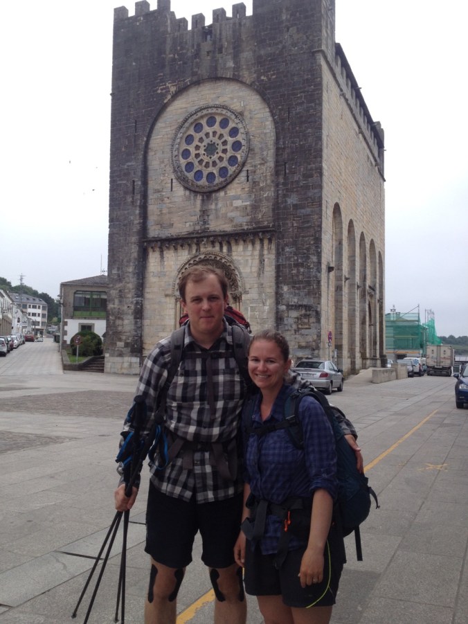
Day 31: Santiago to Negreira (20km)

Day 32: Negreira to Olveiroa (33km)

Day 33: Olvieroa to Muxia (32km)

Day 34: Muxia to Finisterre (35km)

*Distances are approximate.  The Brierley Camino guide that we used does not cover the Camino Finisterre, so we primarily relied on internet sources and a free tourist map that we received at our albergue in Negreira. To add to the confusion, many of the towns have two spellings — the Spanish and Galician versions.  For instance, Finisterre (Spanish) is referred to locally as Fisterra (Galician) and Mucia (Spanish) is Muxia (Galician).

Daily Highlights:

Camino de Santiago Day 31/Camino de Finesterre Day 1:

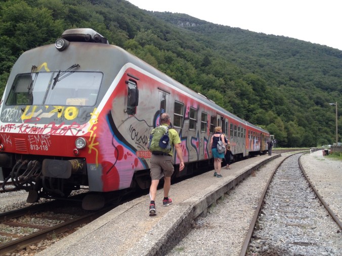
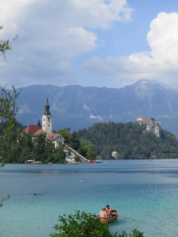
After a month of walking, we made it to Santiago yesterday. So what do we do next? More walking!

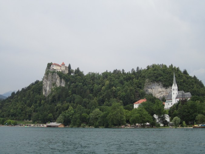
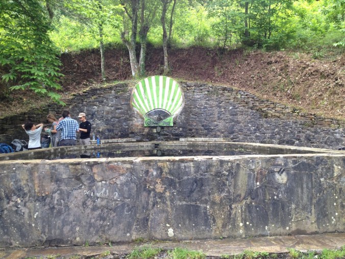
We started the Camino de Finisterre today — the way to the “end of the land.” Historically, many pilgrims would continue on past Santiago until they reached the coastline. We are actually going in a round-about way — stopping first in Muxia (a coastal village further north) and then to Finisterre. The trails run together for two days, then split early on day three, with a fourth day connecting the two destinations.

IMG_6869

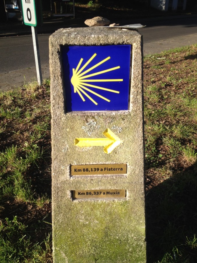
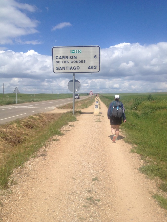
Mileage marker just outside Santiago to both Fisterra and Muxia

Since we had worked so hard to get to Santiago (and stayed up for soccer last night), we slept in. We didn’t leave our hotel until 8:00 a.m.!!!

IMG_6876

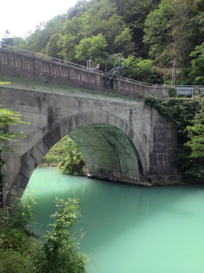
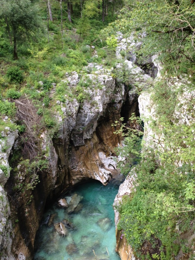
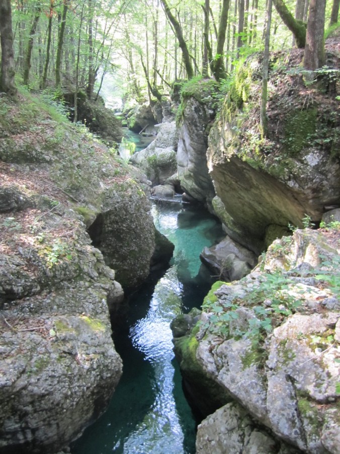
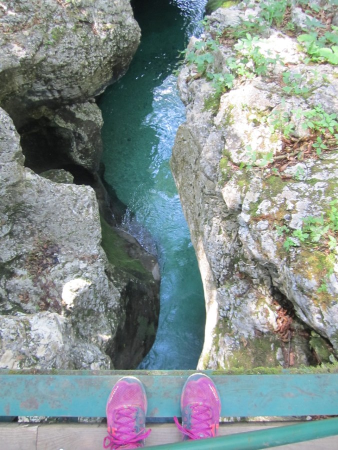
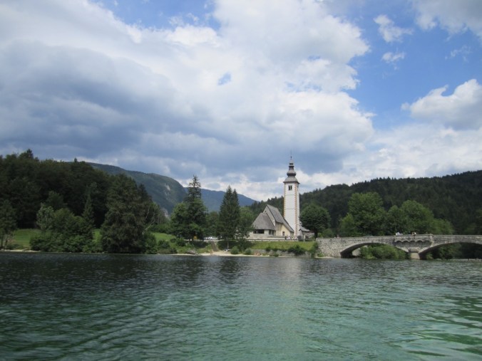
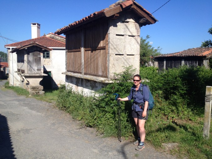
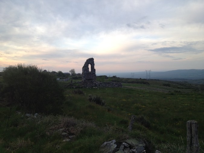
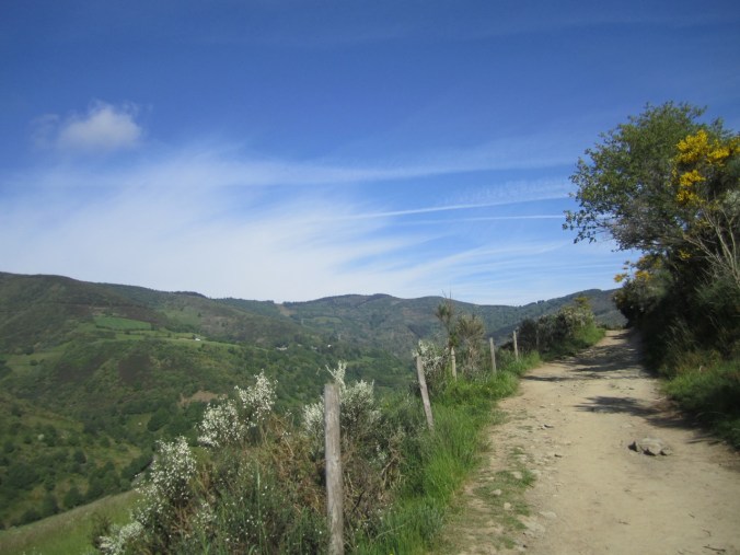
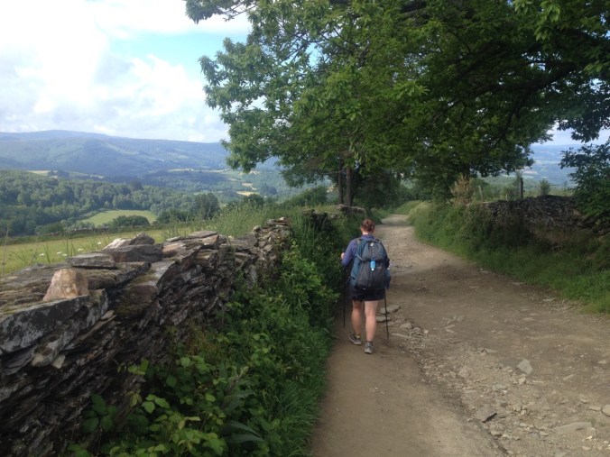
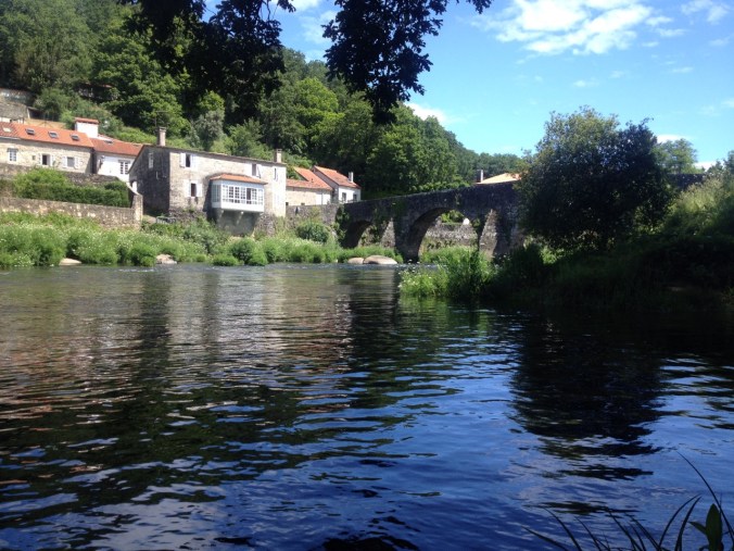
Today, thankfully, was the short day. There seems to be limited accommodation west of Santiago, so there are not lots of choices for where to stay. We hiked roughly 20 km, though the same type of terrain we saw in most of Galicia. At one point we put our feet in the river (second time!), and enjoyed a really excellent view of a cute town and bridge.  There were far fewer pilgrims on the trail today (although there was some kind of community walk headed in the opposite direction as us).

IMG_1490

Cute town along the way (name unknown — we have no map for the first day’s walk out of Santiago).

IMG_6873

View as we soaked our feet.

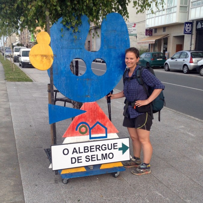
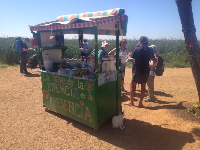
When we arrived in Negreira, we booked our beds in Albergue Lua (getting extended instructions from our host regarding what to expect the next few days, including a much welcomed map), and after a trip to the supermarket stopped at an “English Pub,” where we enjoyed cider and O’Hara’s beer (it’s like Guinness but not as good).

As we drank, a bunch of bicycles passed us along the street. It turns out that there was a triathlon going on while we were there. It was 20k of bicycling and 5k running, plus however long the swim was. As the bicycling was finishing up, we walked over to the arch at the other end of town, where we saw the athletes finish their runs and get their final time. They had the whole Camino blocked! It’s a good thing that we got where we wanted to be before the race started.

IMG_6889

The end of the triathlon.

Elizabeth is feeling sick again.  Her cough has finally started to get better and now she’s sneezing again and afraid the cycle has started over again.

Camino de Santiago day 32/Camino de Finisterre day 2:

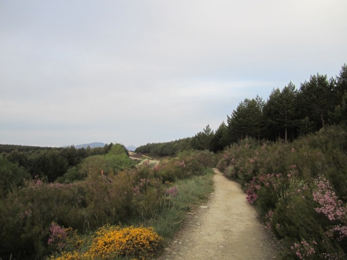
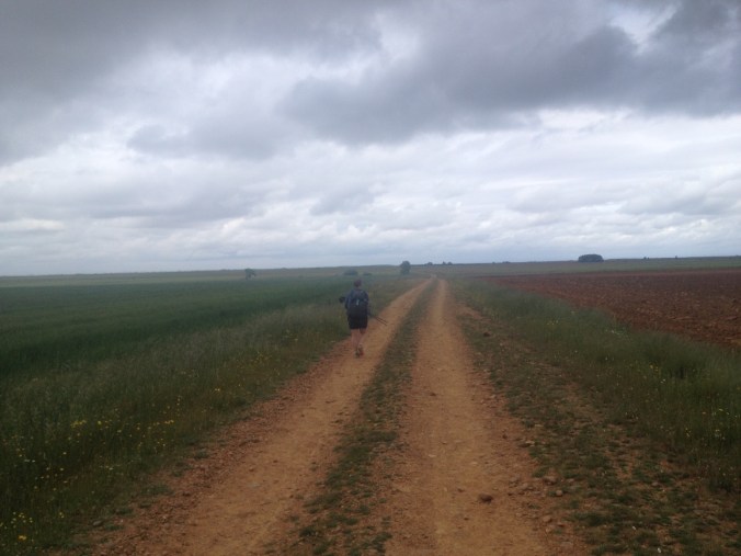
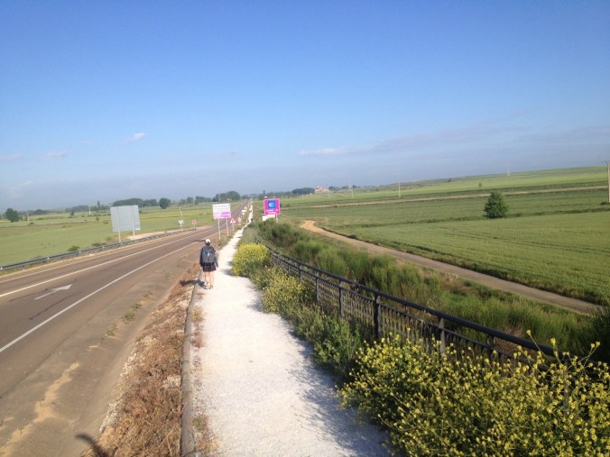
We woke up at a more normal time and got on the trail before 7:00 this morning for the longest day of the Camino Finisterre. It was a lot more of the same type of terrain, but a little bit less well-marked. At one point a bicyclist passed me and told me that Elizabeth was behind by at least a kilometer. This was surprising since she had been ahead of me and I had hurried to catch up but couldn’t get her in sight (I had stopped briefly to put on my rain jacket, which to me explained the gap). I turned around and met her back on the road, learning that she had taken a wrong turn and had sought out the bicyclist to send the message up ahead.

IMG_1492

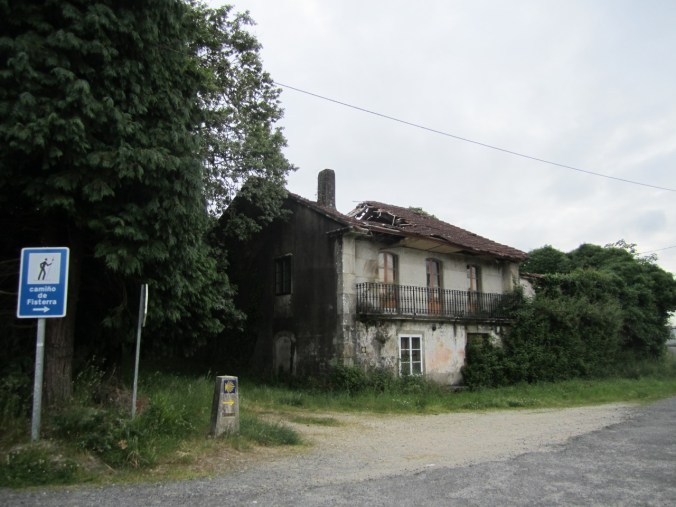
Can I interest you in a fixer upper? We passed many buildings in need of some TLC along the Camino.

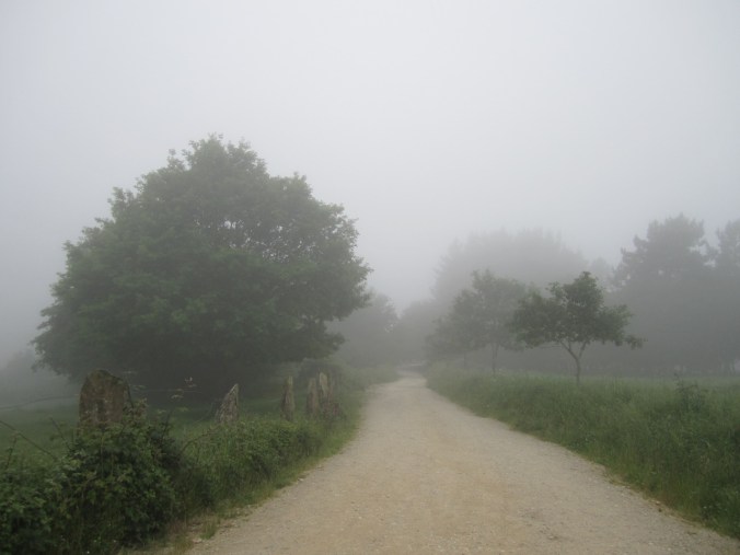
It rained a little during the day; not much, but it felt like hours of walking through a cloud. More than anything, it was a tough day because it was about getting back into the habit of walking a longer day. Apparently they have a word for this light rain in Gallego (the Galician language) that literally translates as “the rain that gets dumb people wet” — because it seems like you shouldn’t need a rain jacket, but before you realize it you’re soaked (also really, with such rain, why not go inside?).

IMG_7022

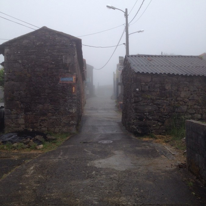
Rain? Fog? Mist? Wet.

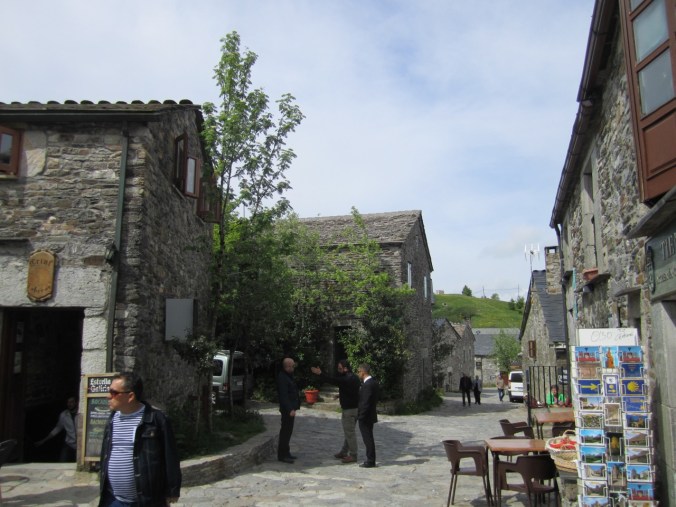
We spent the night at the municipal albergue in Olveiroa, another super small town that seems to only exist for the Camino. We enjoyed talking with a Korean couple that lives in Hawaii while we cooked our lunch at the albergue (they stayed at our albergue last night too). We’re starting to notice that most of the people walking the Camino de Finisterre also started in St. Jean like we did; these are not the people that started at the 100km mark in Sarria (perhaps because we’re the only ones that can spare another 3 or 4 days? or are crazy enough to keep walking?).

Camino de Santiago day 33/Camino Finisterre day 3:

We got an earlier than ordinary start on our way to Muxia this morning. We were greeted with rain. The rain was not as hard as it was a couple weeks ago before Leon, but it lasted longer and just kept raining for the first half of our hike today. In a 30 km day, that’s a long time to walk in the rain.

IMG_6911

Trail split.  And rain.

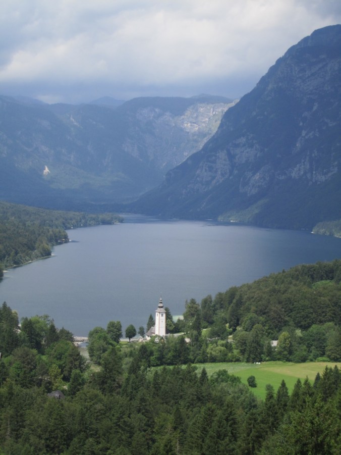
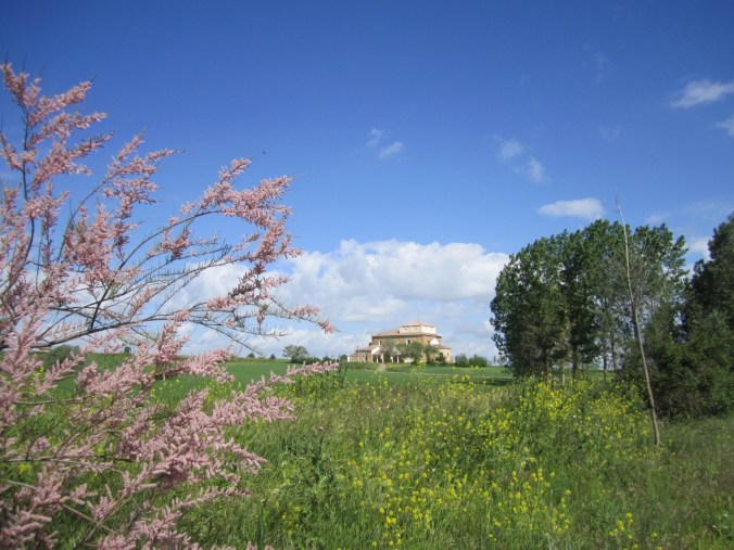
Fortunately the rain softened and then ended after our morning break in Dumbria (about 10km into the day), and most of our day was under cloud-cover. Shortly after the sun came out we heard sea gulls and found our first view of the ocean! In another few km we were in Muxia, a small village out on the cape that borders a large bay. 

IMG_6916

Our first glimpse of the ocean!

IMG_6923

Approaching Muxia.

Unlike most of our days on the Camino, where we are done walking once we get to the albergue, in Muxia we had another couple km to go before we could call it a day.  We left our stuff at the albergue and then walked a final km out to the end of the peninsula.

IMG_1494

Dramatic end to our walk to Muxia.

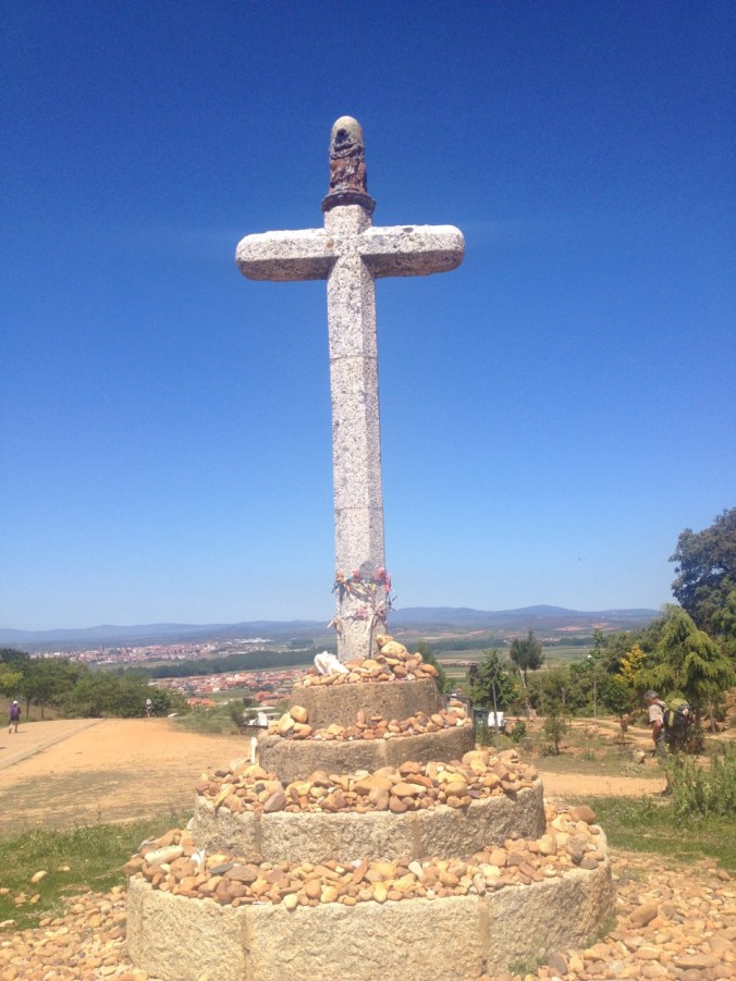
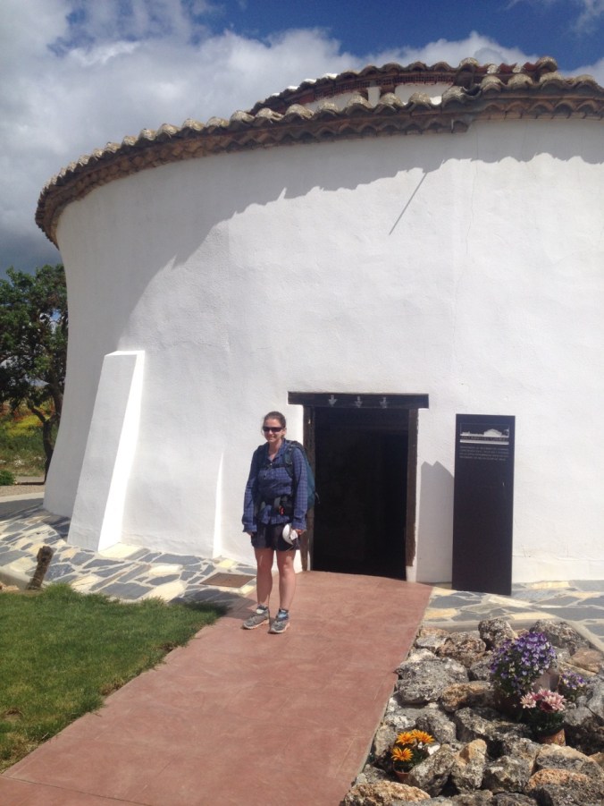
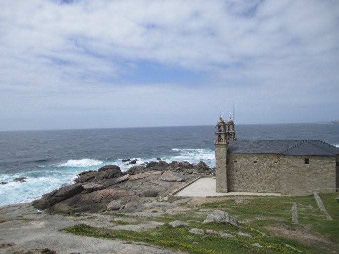
According to legend, Saint James came to Muxia to evangelize and the Virgin Mary arrived in a stone boat to encourage him to keep on spreading the word. There is a church at the end of the peninsula marking the site, and although it was not open when we arrived, there were a couple windows designed to let tourists see in. We spent some time sitting on the rocks along the water and were about to head back to our albergue when we saw a familiar sight — one of the Canadian couples that we had seen off and on throughout the Camino (from our second night to the day that we passed through Villafranca).  They had finished the Camino and had bussed out to Finisterre and Muxia for the day and just happened to be there as we were walking back!

IMG_6941

Looking down on Muxia.

I rounded out the night by going out to a bar to watch part of the Italy vs Belgium soccer match. Or so I thought. It turns out that the Euro 2016 soccer tournament is on one channel in Spain, and that channel decided to show only one game per day. Because Spain played in an earlier game, Italy/Belgium was not broadcast.

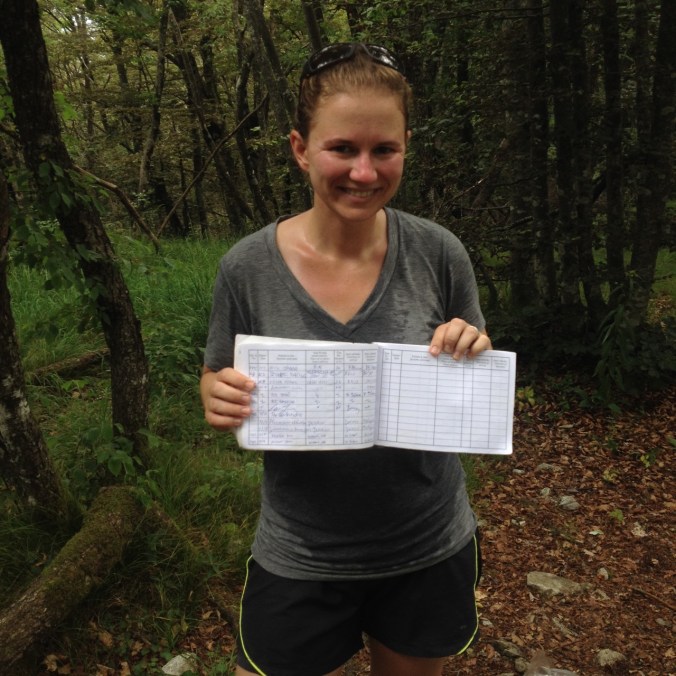
[Elizabeth’s note: As noted above, we have seen far fewer pilgrims since leaving Santiago.  This was especially evident today, since we split from the trail headed directly toward Finisterre after about 5km.  After the split, we only saw a single group of pilgrims just before arriving in Muxia.  Similarly, there are only about a dozen pilgrims staying in the municipal albergue here.  The albergue itself is a huge, modern building that is weirdly empty (partly by design as there are not many beds but probably 3 chairs per bed spread throughout the facility). One treat at the municipal albergue is that we received another certificate stating that we have walked to Muxia — it’s in Gallego instead of Spanish!]

Camino de Santiago day 34/Camino de Finisterre day 4

Last day on the Camino!

Finisterre literally means “end of the land.” It is believed that pilgrimage to Finesterre is much older than the Camino, as the celtic peoples of pre-Christian Galicia understood it as the westernmost point in Europe (it isn’t — there are places in Ireland and Portugal further West).

Before we started the day — actually during our lunch break yesterday — we booked an apartment to stay in for a few days after we finish the Camino. Since we had a few requirements (internet, washing machine) we ended up booking a place in Muxia. But we still wanted to finish the Camino at Finisterre, so we left our albergue in Muxia with our bags, walked past our apartment for tonight, and continued on to Finisterre, planning to to take a taxi back to Muxia.

IMG_6969

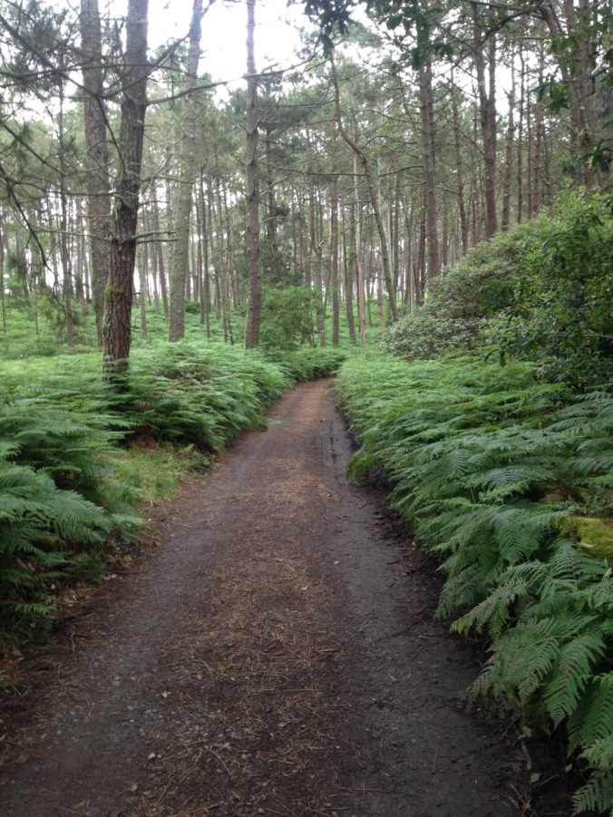
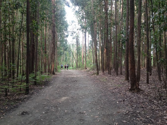
More of the “green tunnel” for our final day of walking.
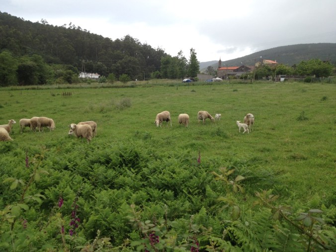
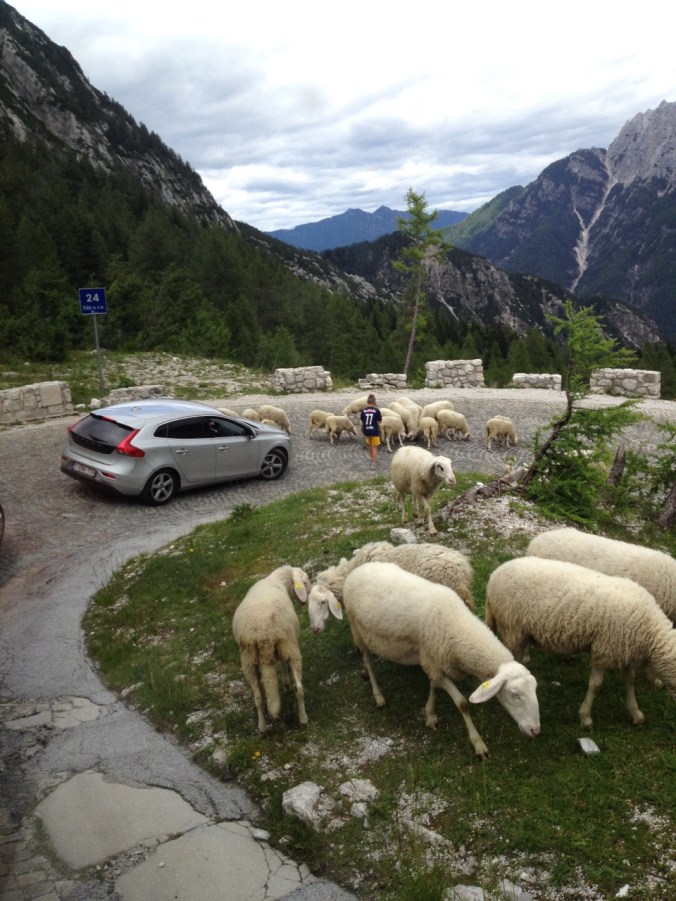
IMG_6968

More sheep.

Today’s path starting along the coast by a beautiful beach with a view of what appeared to be a  half-built luxury hotel. Then the trail turned inland and climbed a mountain. We could see serious clouds up ahead and were determined to make it to the top before the bad weather hit.

IMG_6961

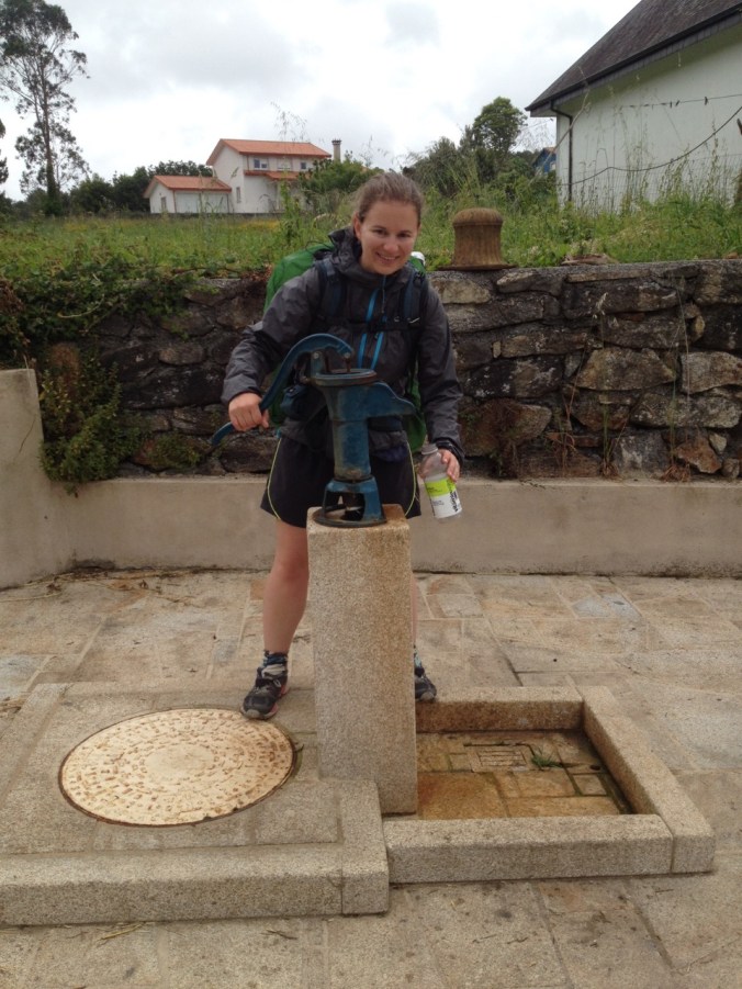
Trying out one of the more unusual water pumps along the Camino.

We made it over the top and part way down the other side before we had to get out our rain gear, and even then it never rained too hard. The terrain was lush and often forested, and we made our way to the single cafe on today’s route (at about the 14km mark) before making our way into the town of Finisterre. As with yesterday, reaching town did not mean that we were done walking — there was another 3 km to the lighthouse at the end of the land.

IMG_6978

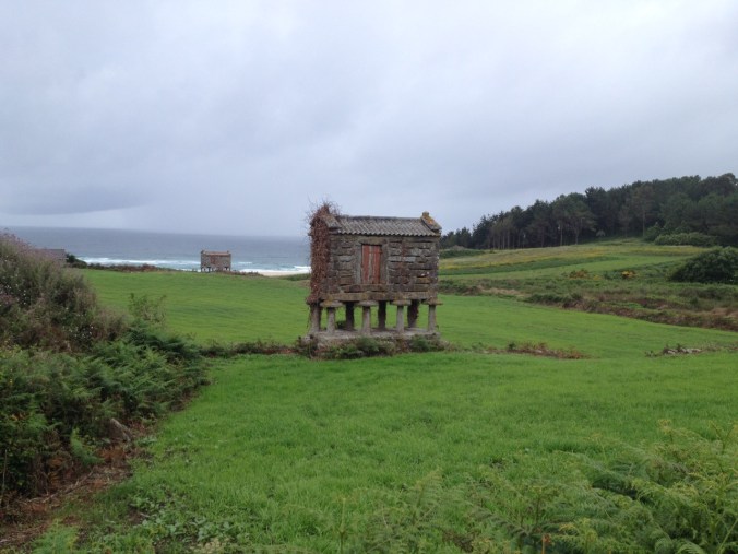
More traditional horreos along the coast.

As we entered Finisterre, it began to rain so we stopped for hot chocolate. We figured out where we would later go for our “Finisterrana” — our certificate of making it to Finisterre — and I discovered a restaurant serving real curry by smell (I’m quite proud of that) that we decided would be our treat once we returned from the lighthouse.

Then we headed out to the lighthouse at the end of the land. Since we weren’t staying in the town of Finisterre, we carried our full backpacks. On the way up, we ran into a couple from Washington state who we had walked with over a week ago as we headed into Rabanal (they had bussed to Finisterre), and talked to them during our final kilometers. And then we reached the end.

IMG_1498

Our final marker — the 0 kilometer marker!

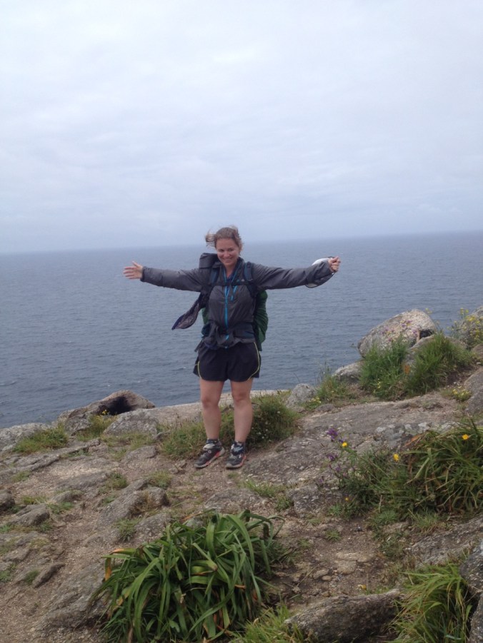
I had felt incredibly excited when I reached Santiago; I was emotional at Finisterre. There was a bagpiper next to the lighthouse and I had to hold back a few tears as I realized this was coming to an end, with a fitting soundtrack. It’s not that I wasn’t ready to finish — my feet definitely were ready to be done — but it’s a bit overwhelming, and being up on cliffs — which really do feel like the end of the world — makes it more powerful.

IMG_7007

At the end of the world!

IMG_7015

So windy.

Just past the lighthouse it became much more windy. We took a couple pictures and watched a few people ceremonially burn possessions (we had nothing sufficiently flammable, dry, and disposable to burn). As we started walking back, we took pictures for a German couple. While there are many people out at the point, few have their full backpacks. Most took a vehicle at least to the nearby town, if not to the point itself. They noticed our backpacks and asked how far we had walked and congratulated us when they heard it was from France. That felt good.

IMG_7040

Our shoes have earned their retirement — job well done!

Before heading back to Muxia we had our curry lunch (pretty good actually), picked up our Finisterana, and met up with Kat from Australia (who’d chosen to give her feet a break and drove to Finisterre for a few days relaxation). Cabbing back to Muxia was interesting both because we haven’t been in a motorized vehicle since St. Jean over a month ago and because although we took a different route than we walked, we covered today’s walk in about 30 minutes (prompting Elizabeth to get carsick).

We’ll be spending the next couple of days letting our bodies have a chance to rest in a wonderful apartment overlooking the ocean in Muxia.  Rain is forecast for the rest of the week, so I expect that we’ll spend much of the day inside admiring the view.

IMG_1873

View out the window of our apartment.

IMG_1872

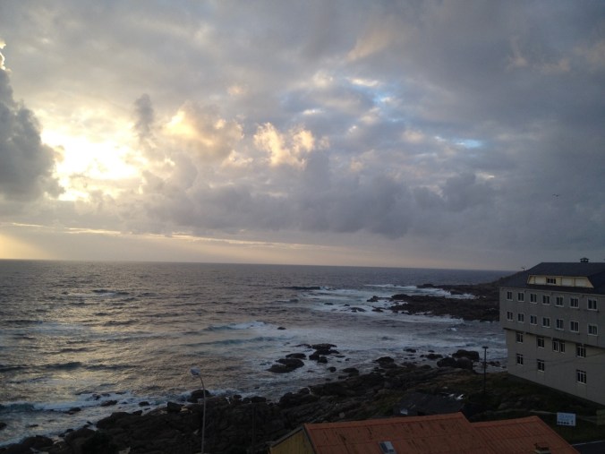
Enjoying sunset amidst the clouds.

And now to relax and sleep in past 5:45am!

Camino de Santiago, Days 27-30

By Michael

At a Glance:

Day 27: Barbadelo to Ventas de Narón (31.3 km)

Day 28: Ventas de Narón to Boente (32.3 km)

Day 29: Boente to Pedrouzo (28.1 km)

Day 30: Pedrouzo to Santiago (19.8 km)

Daily Highlights:

Day 27: Today we started in heavy fog in Barbadelo, which lasted through Portomarín (roughly half way through our day). The kept us from having any view of the surrounding hills, but it also kept us cool and it was beautiful in the fields and forests we walked through.

IMG_1472

The official Camino mascot for the Galicia region, as seen through the fog.

IMG_1476

Our “view” the first couple hours of the day.

Just under two hours into our hike, we were approaching the 100 kilometers mark (left before reaching Santiago). The Church will only give a “Compostela” to pilgrims who walk over 100 km. And here in Galicia, they have installed new signs that say the precise distance to the cathedral in Santiago — down to three decimal points (equivalent to one meter). We were looking for the marker at 100 km — Elizabeth remembered it from her last walk — but after seeing 100.something, we saw 99.930 km. So the official 100 km mark was some 70 meters back and unsigned. To deal with the disappointment of missing her 100km photo, Elizabeth posed for an even more silly photo.

IMG_1475

Not impressed.

Not to be outdone, I paced back roughly 70 meters and took a photo. It turns out that the 100 km mark is in between a couple of buildings that I think a barns.

IMG_6781

The view at 100 km (estimated). The cafe on the left is just inside 100 km, so it doesn’t qualify as a stamp outside 100 km.

As we approached Portomarín, we met a mother and daughter from Santa Rosa, California — the mother had started in St. Jean, and had three children (all adults) meet her for different segments of the walk. She was doing awesome! After Portomarín, we continued on and the sun came out.  It was hot!

IMG_6794

In front of the castle-like church in Portomarín.

IMG_6799

Finally the sun came out!

We finished walking today in Ventas de Narón, where we watched some sheep graze in a small pasture across from our albergue.

Day 28: There was no fog today — it might have been our warmest morning of the Camino so far so we knew it was going to be hot today.

IMG_6805

Ant statutes along the path.

IMG_1480

Sharing the road with cows on their way to graze in a nearby field.

We finished our first segment at a good pace, up to a hilltop and down to Palais de Rei, where we stopped for breakfast (toast and coffee for me, toast and hot chocolate for Elizabeth) at Cervezeria Obelix. A “Cervezeria” is literally a brewery though in Spain it does not mean they make beer there (everyone serves the same light beer). Obelix is a character in the French cartoon series Asterix. He looks like a chubby viking (I’ve been told he is a Gaul, but look for yourself: Viking.).

IMG_6807

As we continued we saw more rolling hills and small forests, typical of Galicia. And it got hot, even in the shade.

IMG_6811

As soon as we entered Galicia, we started to see “horreos” everywhere.  They were traditionally used to store grain and almost every rural house that we have passed has one.

When we left Melide, a town large enough to have a small grocery store where we could pick up fruit, we saw a sign for Albergue Boente, one of two accommodations in the town down the path where we figured we might stop for the day. The sign said they had a pool, which was news to us. There was even a picture of a paddle board in a pool — probably not their pool, but that was enough. This might have been the fastest 6 km I’ve walked on the Camino to make sure that we got to stay there.

Once we arrived, we each took a dip in the (tiny) pool.  Well worth it.  The rest of the afternoon was spent doing our daily chores, reading, and enjoying a typical pilgrim menu for dinner with wine and desert.  Today was a reminder of how much the Camino has changed now that we are in the last 100km.  We saw several large groups (including a rowdy group of middle-school-age kids) and there are a couple loud groups staying at our albergue that seem to be in party mode.  We are working on our patience.

Day 29: This morning we left Boente early to avoid much of the heat. We arrived in Arzúa (about 8km down the road) — a much larger city and suggested place to overnight in many of the guidebooks — just about at the time that many pilgrims were getting going for the morning. Everywhere along the way there were large groups of pilgrims, showing just how popular the Camino has become, especially in the last 100 km.

IMG_6817

Elizabeth with the Galician Camino mascot.

We also passed through groves of Eucalyptus trees. While perhaps not the same as medieval pilgrims would have experienced (when these trees were confined to their native Australia), they reminded us of Nipomo, California, where there are miles of Eucalyptus trees planted in rows.  They provided much needed shade.

IMG_6818

Because of our early start and relatively short day, we arrived at our destination of Pedrouzo around lunch.  There was no point in going any further because it is less than 20 km to Santiago and there are no good accommodation options in the next 15 km or so.  After checking in, we had a three course pilgrim menu for lunch. Scrambled eggs with good mushrooms as first course was a highlight for me.

We both took needed naps in the afternoon. Tomorrow we leave early for Santiago!

Day 30: Today we made it to Santiago! We started early despite the short distance, hopeful that we could finish before the mid-day heat and most of the crowd. Well, the mid-day heat never happened and there was almost always at least some crowd, but it was still fun to walk through the forest in the dark.

Around one of the earlier cafes, we ran into a group of pilgrims we had met earlier on the Camino. The group included Cat from Australia and Will & Hannah from Seattle, and seemed to be growing. We saw them a few times during the day, and I stayed at their pace to chat for a while before taking off on my own.

After winding through the outskirts of Santiago, I walked through a covered passage (with a bagpiper) to the main square, looking up at the Cathedral and it’s (roughly) two floors of steps up to the entrance. It’s a pretty amazing moment, and difficult to describe. I was feeling excited and I wanted to run up the stairs. It turns out that the main door at the top of the stairs was closed due to a restoration project, but I decided to run up anyway.

[Elizabeth’s note: Entering Santiago today for the second time was understandably much less emotional for me than it was my first time.  I attribute this to the fact that I knew exactly what to expect, I am not in the same physical pain that I was on my first Camino (other than sore feet and a sore rib from coughing, I feel pretty good), and I know that I still have four more days of walking ahead of me so this isn’t the end of the journey.  Still, I’m proud of having walked all the way from France to get here!]

IMG_1487

IMG_6851.jpg

We went to the “11:00 a.m. mass” which it turns out didn’t exist. So we waited — meaning we had really fantastic seats for the noon pilgrim mass. It was in Spanish and Latin, so we didn’t understand much except that they announced the countries from which pilgrims finished the Camino yesterday and that you had to be Catholic to take communion. And then, unfortunately, they did not swing the giant incense burner (known as the Botafumeira).  That was a bit of a disappointment, since it’s supposed to be a highlight of finishing the Camino.  We understand that the Cathedral only does it one time per week for free, but that often groups pay the 300€ fee to have it done during other masses.  Luckily, the free Botafumeira mass was later this evening. Since Elizabeth had seen the Botafumeira a few times on her first Camino (her video of it swinging is here), I planned to go back alone for the 7:30pm mass.

We spent the afternoon visiting the pilgrim’s museum and standing in line to get our official Compostela. We also got a fun, optional certificate that attests that we walked 775km to get to Santiago!  When I returned to the Cathedral for the 7:30pm mass, I found that it was even more popular than the noon pilgrim’s mass and  I could not find a seat. But I did run into the same group of Australians and Americans that we’d run into earlier in the morning.  Watching the Botafumeira swinging was amazing — it ended up swinging much higher than I had expected.

IMG_6842.jpg

It was hard to get much of a picture from inside the Cathedral, in part because the gold altarpiece shown so brightly.  At the center of the alter is a statute of Saint James (whom the city and Camino are named after).  Pilgrims and visitors can approach the statue from behind to wrap their arms around Saint James’ shoulders.  Quite a weird sight during mass.

We then left for dinner, where I enjoyed octopus, beer, and the beginning of the European Soccer tournament (France beat Romania 2-1). The proprietor of the bar where we ate was an older man who turned out to be tons of fun (and kept insisting that we drink and eat more).  Unfortunately, we knew that despite having reaching Santiago, tonight could not be a party night…

Camino de Santiago, Days 23-26

by Michael

At a Glance:

Day 23: Rabanal to Ponferrada (32.7 km, via original route into Ponferrada)

Day 24: Ponferrada to Trabadelo (34.9 km, via alternate high route out of Villafranca)

Day 25: Trabadelo to Fonfría (30.6 km)

Day 26: Fonfría to Barbadelo (31.1 km, via San Xil route)

Daily Highlights:

Day 23: We left our beautiful albergue in Rabanal early this morning to head up the hill toward Cruz de Ferro (a cross up the hill).  This is one of the bigger climbs on the Camino and we started walking while it was still dark. We could see the sun rising behind the town and the lights of Astorga in the distance as we climbed up. As the sun came out, we could also see the surrounding mountains. Much of the flat part of Spain that we have just passed through is pretty, but I needed my mountains, and this was my fix.

IMG_6652

Turning around to see the sunrise as we walked up the hill.

IMG_1438

Beautiful, natural pathway heading into the mountains.  A nice treat after so many road walks recently.

Many people look forward to reaching Cruz de Ferro because of the tradition of bringing a rock from home to be left at the cross.  The act of leaving the rock is supposed to symbolize leaving behind a burden on the Camino. We reached the cross and took pictures in the gray morning, watching as others left rocks, photos, and other trinkets. We both forgot to bring a rock from home to leave at the cross, so we made do with admiring the scenery and watching others (some of whom were very emotional).

IMG_6667

Atop Cruz de Ferro.

We then made our way down the mountain — a mountain similar to many of the coastal hills in California, except much higher and steeper. At the bottom we reached the cute town of Molinaseca, where we put our feet in the cold river for a few minutes before continuing to Ponferrada. Today was the first time on the Camino that we were able to relax on a river bank with our feet in the water (something we did multiple times a day on the JMT to combat swelling feet) and it felt great!  It helped prepare our feet for what ended up being a hot road walk as we continued another 7km or so into Ponferrada.

IMG_1444

Our view of Molinaseca from the riverbank.

On her first Camino, Elizabeth missed the open hours for the Ponferrada castle, so this was a priority. It was worth it — a Templar castle that has been restored and had interesting exhibits on display. We finished our day with wine on the square and dinner in a somewhat hip restaurant with Rosie the Riveter as the mascot on the sign outside.  For Elizabeth, the morning spent in the mountains made today was one of her favorite days on the Camino thus far.

IMG_6686

The castle in Ponferrada — looks like a castle!  Despite the heat and our tired feet, we enjoyed walking around to explore the grounds.

IMG_6698

Random statute in the mail square celebrating brewing?

Day 24: According to our guidebook, hiking from Ponferrada to Villafranca is supposed to be a nice, solid walking day. So today we hiked the suggested day, and then added 10 km with about 400 meters ascent and decent at the end.

IMG_6710

Graffiti on the way out of Ponferrada.

The first half of the hike was in and out of small towns. At 9:00 a.m. we arrived at Vinos de Bierzo, where they offer wine and tapas in the winery. We decided that it was 5:00 p.m. somewhere, so we had a glass of wine each. Our hike continued from wine tasting to vineyards, up and down several hills on the way to Villafranca.  For the last few kilometers into Villafranca, we were treated to free entertainment in the form of a puppy out for a walk with way too much energy — it darted up and down the trail so much it likely traveled twice as far as we did.

IMG_6731

Our second breakfast for the day — wine and empanada.  Yum.

IMG_6723

Rolling hills through vineyards on the way into Villafranca.

We arrived in Villafranca just after noon. We were feeling good so we decided to hike an additional 10 km.  This decision was largely due to the fact that we wanted to be “off Brierley” so that we would stay in smaller towns that were not recommended end-points in the Brierley guidebook in hopes that finding available beds would be easier.  Before moving on though, we decided to have lunch first. We had a garlic shrimp pizza — it was a tasty meal and was filling for the afternoon hike, but it took about an hour from when we ordered to when the pizza arrived on our table. Lesson learned.

The final segment was an optional path — the official route follows along the road and stays much lower — but we wanted the challenge and Elizabeth had heard on her first Camino that the optional route was beautiful. The hike up was steep and hot, but the views were amazing. The “top” was elusive — twice we thought we reached the top but we then turned a corner around a hill and saw we had more climbing to do. The way down had more shade, but was very steep.

IMG_1454

Walking along the high route out of Villafranca.  Beautiful, but exposed and very hot.

IMG_1455

View along the optional high route out of Villafranca.  The official Camino route is along the road at the bottom of the valley (but luckily, not the big highway pictured).

Once we arrived in the small town of Trabadelo we relaxed and found an interesting spot for dinner. Elizabeth had Korean kimchi with rice and noodle soup, and I had a burrito (actually quite good) with chips and salsa. We suspect that the restaurant was run by hippies, and we were thankful for it.

Day 25: Yesterday’s extra segment paid off today. We got our usual early start and, with Trabadelo in the bottom of a deep valley, we walked in the shade for a few hours. After a few towns and a stop for toast, we started our 900 meter climb to O’Cebreiro. The first segment was lush and green, almost like Hawaii. Then we passed a couple towns above the forest, and had great views of the mountains. It reminded me of the Cuesta Grade on the central coast of California.

IMG_1457

Walking up to O’Cebreiro.

IMG_1458

We passed into the Galicia region just before reaching O’Cebreiro.  The sign must have been recently repainted, because Elizabeth’s picture of the monument shows that it was previously covered in graffiti.

Near the top of the mountain is the town of O’Cebriero, a pretty town of gray stone buildings. On her first Camino, Elizabeth arrived here and the Albergue had no rooms left. We arrived before 11:30, so we had planned to go on (to avoid what happened to Elizabeth last time), but we did stop for lunch and cider. Several peregrinos were already waiting for the albergue to open an hour later as we headed out of town.

IMG_1461

The cobblestone streets and stone buildings of O’Cebreiro.

We continued on another 12 km, with spectacular views of the hills of Galicia. We finished in the small town of Fonfría — a town with one albergue, a small inn, no shops, and several cows (that walked right past the albergue while I was doing our daily clothes washing).

Dinner was family style with everyone in one large room — a round stone building with a pointed roof (no photo of this building, but I promise a picture of a similar building later). After dinner, a group of peregrinos were (self) appointed to finish the bottles of wine that were left on the table.  We may have been part of that group 😉

Day 26: As we packed our bags in Fonfría this morning, we heard the sound of raindrops. While it wasn’t much today, it was a warning that Galicia has more rain than anywhere else in Spain. In the light rain we made our way down the mountain to Triacastela, a city named for three castles, none of which exist today. So we got some toast with butter and jam instead, and moved on.

IMG_6750

Water fountain along the path.

The hills here are lush and green, the “towns” often have gray stone buildings, and there are stone walls separating pastures that look as if they have been there for centuries (some of them probably have). Elizabeth crossed paths with some cows and their farmer — one of the cows decided to lick her hiking pole to find out if it was edible (it was not), and a tap from the farmer told the cow to move along.

IMG_6754IMG_6760

We made our way to Sarria, which is the starting point for most of the shorter distance hikers. To earn a “Compatella” (the certificate of completion) a pilgrim must walk at least 100 kilometers. Sarria is the last city before the 100 km marker, so the last group of people to join the walk join here — or so we thought.

After a brief stop at a cafe, we continued to Barbadelo. It’s not much of a town (small collection of buildings?), but one of the albergues has a swimming pool. Of course, when we arrived they were already full. But then they gave us a flyer for a different albergue, and offered that we could return to order dinner and use the pool. So we did (it was HOT).

IMG_6763

Pulpo (octopus) for dinner!

The pool was great. It was cold enough to feel good, but not so cold to make you get out. We even put our feet back in after we dried off. After chatting with a fellow pilgrim from Manhattan, we had dinner on the patio overlooking the Camino (a country road at this point) and the pastures. Then we saw taxis arrive, ferrying pilgrims who wanted to walk the minimum 100 km but get a start past Sarria (since Barbadelo is technically outside of 100 km, I guess it counts). They rolled their suitcases up the path — clearly they have booked luggage service (where they transport your luggage for you to the next town so that you just carry a small daypack). So if you think you can’t do the Camino, think again!

IMG_6767

A panorama of the Camino near Barbadello.

Camino de Santiago, Days 17-22

by Elizabeth

At a Glance:

Day 17: Sahagún to Religios (32.3km, via alternate Roman road through Calzadilla)

Day 18: Religios to León (24.3km)

Day 19: León (0km)

Day 20: León to Vilar de Mazarife (21.8km, via alternate route)

Day 21: Vilar de Mazarife to Astorga (31.1km, via alternate route)

Day 22: Astorga to Rabanal (20.6km)

Daily Highlights:

Day 17: I slept like a rock last night — I was exhausted from our 40km day yesterday!  In most albergues, I am constantly waking up due to people snoring, getting up during the night, or simply in expectation of our early start times.  I forgot to mention in yesterday’s summary, but the albergue that we stayed at in Sahagún was really cool.  It was on the second floor of a converted cathedral with super high ceilings.  Of course, it was a little weird to lie in bed listening as a graduation ceremony take place in the intact portion of the building in the evening. 

IMG_6458

Our view for much of the day (albeit a bit fuzzy).

Today’s walk was somewhat boring.  In order to avoid a full day of walking on the senda (path along a national highway route) we elected to walk the vast majority of the day on an alternate route along an old Roman road.  While that sounded interesting in theory, in reality it was an all day road walk.  The first portion was paved and had some traffic, the second half was a very rocky road with no traffic.  Unfortunately, yesterday’s long walk left me with blisters and hot spots, so the rocky road did not make my feet happy.  I also generally felt very tired and slow today — I wonder why?  The most eventful part of today’s walk was watching the storm clouds heading towards us and then being poured on!  The rain didn’t last long, but we were soaked.

We cut back to the main route in the town of Reliegos, where we spent part of the afternoon hanging out in Bar Elivis.  The walls were covered in “graffiti” and the proprietor was blaring Elvis songs and singing/dancing along for most of the time we were there.  Highlight of the day.

A110EB67-0DC1-455D-BD0D-0D53637F0E10

Bar Elvis!  Complete with graffiti all over the walls and an enthusiastic proprietor.

[Michael’s Supplement: Today was the final of the UEFA Champions League — for those unaware this is the European soccer equivalent of the Super Bowl.  The tournament has teams from across Europe (and apparently Europe now includes Israel and Kazakhstan — who knew?) but the final was two teams from Madrid.  I watched with two Spaniards and an Italian, and we worked through teaching me some vocabulary in Spanish (flopper, offside, etc.).]

Day 18: We’ve made it to León!  I’ve always thought of the Camino as being separated into three sections — with the first section ending in Burgos, the second section ending in León, and then the Camino ending in Santiago.  Arriving in León today means that we are in the final third of the trail.  I’d been looking forward to today’s walk because it was supposed to be a much shorter day than we’ve been walking lately (only 24km).  In anticipation of the shorter walking day and the fact that we intend to stay in Leon for two nights, we slept in a bit and didn’t start walking until around 8am.  Unfortunately, the walk didn’t quite go as planned.  My blister was hurting even more today than it did yesterday and I ended up walking very slowly today as a result. To make matters worse, the rain that we thought wouldn’t start until 3pm came early and we ended up walking for about an hour in the rain.  The route itself was somewhat uneventful.  We walked largely on paths along the road, passing through many small suburbs as we entered the city.  It honestly wasn’t the horrible industrial area that I’d been led to believe the approach would be, but I wasn’t really in the mood for enjoying today’s walk.

IMG_6485

The Camino signs now include the León lion dressed as a pilgrim.

IMG_6489

Marching band as we entered León’s old town.

León itself was very nice.  As we entered the old town, there appeared to be a festival of some sort going on and a band was marching down the street playing really dramatic music.  We splurged and are staying two nights in a four star hotel (not much of a splurge at 60 euro per night though!).  This means that we weren’t in a rush to get out and see the city’s sights as soon as arriving.  We were starving when we arrived in town though and got very excited upon finding a Mexican restaurant.  We miss our burritos and spicy food!  While Michael enjoyed his chips and guac with four salsas, my “tacos” fell far short — they were just cooked meet (without spices) and melted cheese rolled up in flour tortillas.  Oh well, the search for Mexican food continues.

IMG_1422

View from our hotel room!

IMG_6493

My “tacos.”

Day 19: We got to sleep in today!!  Only slept until about 8am or so, but it was glorious.  We spent our morning getting laundry done (finding an awesome laundromat that took less than an hour for the full washer/dryer cycle) and then checking out León’s cathedral.  When I walked the last portion of the Camino in 2012 I walked away feeling that León’s cathedral was one of the best that I’d ever seen.  The light wasn’t as good for today’s visit, but I still think that the cathedral here is amazing.  There is so much more space filled with stained glass than most other cathedrals that it feels much less heavy. 

IMG_6501

León’s cathedral.

IMG_1423

So much stained glass!

We spent the rest of the day walking around Leon’s old town and enjoying a bottle of wine with tapas at the Parador.  There are a bunch of Parador hotels in Spain that were originally built as pilgrim hospitals and they tend to be amazing old buildings (and thus, expensive hotels).

IMG_6537

In front of the Parador the next morning.

IMG_6510

Michael in 2016.

IMG_0439

Flashback to me in 2012.

IMG_6525

Michael with Gaudí.

It was great to have a day of no “official” walking (we did walk quite a bit, but at least I got to wear sandals).  I’m hopeful that my blister will feel much better tomorrow.

Day 20: We eased back into walking today with a short day knowing that we want to spend tomorrow night in Astorga so there was no need to put in a big day.  My feet are feeling so much better!  The walk out of Leon was uneventful — just a lot of sidewalk walking past shops and houses.  We again planned on taking an alternate route that we would actually spend the night on.  Since Leon is a popular starting point, this helped to minimize the crowds of pilgrims that we had to deal with today.  We had a slight mishap finding the turnoff for the alternate route (taking a lovely detour when we turned too early…), but once we found it the path was smooth sailing.  Most of the alternate today was along dirt country road through rolling hills.  It was hot today and we had little shade along the route.  Luckily, we got into town (Villar de Mazarife) at about 1pm, so we were able to spend much of the afternoon relaxing in the shade (and doing our afternoon chores of showing, laundry, cooking, etc.). 

IMG_6543

Another albergue covered in graffiti.

Day 21: We got out early this morning in an attempt to avoid the heat.  The first part of the day was a long roadwalk along a largely straight, flat road.  During our usual morning coffee break (typically Cola-Cao for us, the Spanish equivalent of Nestle hot chocolate but somehow better) we ran into Amy from SoCal again.  It was fun running into part of the old crew as we haven’t seen many people we know since we pulled our 40km day and then spent a full day in León.  As we were getting set to head out again, our path was blocked by a huge herd of sheep and goats.  There must have ben hundreds!  Our video of them passing by (here) is a full three minutes long!

IMG_1425

Sheep!  Goats too.

We walked off and on for a bit with Amy, passing through the adorable town of Hospital de Orbigo.  The town was the perfect backdrop for a Renaissance festival and appeared to be set up to host one as we passed through. 

IMG_1432

Entering Hospital de Orbigo.

It’s another hot day with more rolling hills and dirt road walking today.  We joined back up with the main route just before Hospital de Orbigo and there are a bunch of people on the trail today.  Just as we approached Astorga, there was a railroad track crossing that they’ve constructed a large pedestrian bridge to cross.  The bridge had several switchbacks, so you could see everyone in front of and behind you even if they had been too far away to see previously. 

IMG_6575

Fruit and juice stand (with cat) as we approached Astorga.  We both enjoyed a nice slice of watermelon — perfect in the heat!

IMG_6579

Cross as we approached Astorga.

We spent the afternoon exploring Astorga — something that I regretted not being able to do on my prior visit.  We enjoyed drinking beers on a bench in the main square, walking through the old town, and visiting the Palacio Episcopal designed by Gaudí (and now housing a museum on the Camino).  We’ve run into more of the old crew in Astorga, including the Dutch couple that we seem to be following (or are they following us?).  We’re also starting to see many new faces from the crowd that started in León or pilgrims that started earlier but walked more slowly than us.

IMG_6587

In front of Gaudí’s Palacio Episcopal.

IMG_6592

This is the backpack I need!  Then Michael could just carry me 😉

IMG_6621

Enjoying a beer back at the albergue called “Peregrina.”  Couldn’t pass it up since I’m a peregrina too (a female pilgrim)!

Day 22: Today was my first repeat day with my first Camino (in September 2012).  Walking out of Astorga, it was fun to think back on my experience four years ago and the places that I stopped and people that I met that first day.  The day was beautiful — the weather was great and the hills were green with lots of wildflowers and trees (that weren’t in straight lines as most of the trees that we’ve been seeing have been!). 

IMG_6631.jpg

Typical view on the trail today.

We split up for much of the day’s walk, although ended up within 5 minutes of each other for most of the day.  As single walkers, we each spent time walking both alone and with other peregrinos for chats.  Although we arrived in Rabanal before 11:30am, we had decided ahead of time to stop here because I had a very positive experience at the donation-based albergue in town on my first Camino and wanted to come back again.  The albergue lived up to its hype (in my opinion).  After waiting in the shade eating and drinking, we were warmly greeted by the hospiteleros (volunteers running the albergue).  We spent much of the afternoon walking though the (tiny) town and enjoying the albergue’s huge garden out back. 

IMG_1864

Garden area next to the albergue.

In the evening, we attended vespers (traditional gregorian chanting) in the small, stone church next to the albergue.  It reminded me of when I did the same thing four years ago! 

IMG_6641

Inside of small church in Rabanal.

I know I’ll have to try to avoid pointing out every little thing to Michael that reminds me of my prior Camino, but it’s been fun to walk (both literally and figuratively) down memory lane.

Camino de Santiago, Days 12-16

By Elizabeth

At a Glance:

Day 12: Burgos to Hornillos del Camino (21.0km)

Day 13: Hornillos del Camino to Itero de la Vega (30.7km)

Day 14: Itero de la Vega to Frómista (14.3 km)

Day 15: Frómista to Carrión de los Condes (20.2km, including alternate path through Villovieco)

Day 16: Carrión de los Condes to Sahagún (40km, including alternate paths into Ledigos, Terradillos de los Templarios, and past San Nicolas del Real Camino)

Daily Highlights:

Day 12: Despite our prediction that staying in a private hotel room would mean that we’d get out faster in the morning (because we wouldn’t be forced to pack silently in the dark), we got a slow start this morning and left at about 8am.  My ankle is still acting up, making walking somewhat painful.  I spent the morning focused on maintaining a normal stride so that I do not develop any additional issues by compensating for the injury. 

IMG_1393

Looking down from a mesa on the meseta.

Today we officially entered the “meseta.”  This portion of the Camino is often referred to with dread — the land is very flat and there is little shade.  Based on the descriptions that I had heard, I’d imagined the meseta as being similar to walking along California’s I-5 during the summer.  The weather today was warm and we quickly learned that one of the side effects of the flat land is that you can see further along the path.  This emphasized just how many peregrinos are in on the Camino — a number that seems to have grown as we exit Burgos since it is a popular starting point (a large group of college students is staying in our albergue, having just finished their first day).  That said, what I’ve seen of the meseta is not quite how I expected it to be.  The land is very green and fertile with wildflowers along the path, not the brown land of California summers.

IMG_1392

Small church along the path today (either in Rabé de las Calzadas or Tardajos).

IMG_6363

Camino grafitti

Due to the heat, later start, and concerns about my ankle, we decided to put in a short day and only walk the Brieley stage of 21km to Hornillos del Camino.  We’re staying at a private albergue instead of the municipal one because the private one sounded like it would have better facilities.  Turns out that the facility itself is nice, but not very functional.  The nice kitchen has almost no pots or utensils — our plan to cook an omelette for a late lunch morphed into scrambled eggs when we discovered that there were no spatulas — and the albergue forbids outside beverages (especially weird in Spain since there are no restrictions on open containers more generally — which we took advantage of).  The Brierley stages for the next few days are pretty short, so we’re hoping to put in a longer day tomorrow in order to skip ahead a bit.

Day 13: I woke up this morning with a very sore throat, making it difficult to talk and painful to swallow.  Luckily, after about 5km or so, my ankle started to feel a bit better.  We were treated to a gorgeous sunrise as a reward for our early start. 

IMG_6364

Looking behind us at the sunrise through the hills.

IMG_1394

It was FLAT for much of the day.

The morning’s walk was pleasant — we passed through the small village of Hontanas and past the ruins of the San Antón convent.  I’m guessing that the ruins were featured in the movie The Way (starring Martin Sheen about the Camino) based on the vendors/tour buses.  We arrived in Castrojeriz after about 20km and ran into a nice older Dutch couple that we’ve repeatedly crossed paths with.  They were able to direct us to the town’s pharmacy, were I picked up some throat lozenges and vitamin packets.  Since I was feeling fine other than my throat (and that isn’t really affected by hiking), we decided to walk on another 10km to Itero de la Vega. 

IMG_1396

Ruins at San Antón convent.

IMG_1398

View walking into Castrojeriz.

The municipal albergue here is basically a spare room across from the church that they’ve put beds in (single beds, not bunk beds!).  There isn’t a full-time attendant, instead you find a spare bad, make yourself at home, and a woman stopped by in the evening to collect the town’s 5 euro a piece!  We’ve once again run into familiar faces at the albergue (Pete, an Aussie we first met in Tosantos and Kat, who we met in Atapuerca).

Day 14: Ugh.  This morning I woke up feeling even worse.  Swallowing was incredibly painful and I was feeling feverish.  I’m worried that I might have strep.  Given the lack of facilities in Itero de la Vega, however, there really wasn’t an option other than walking on.  After a couple kilometers, I knew that there was no way that I could put in a full day of walking (let alone the extra distance that we’d planned).  I couldn’t get warm, despite wearing my down jacket (which I normally can’t wear while hiking because I overheat).  We stopped in a cafe about 8.5km down the road for our morning hot coco and to rest.  Perhaps sensing that I wasn’t feeling well, a cat jumped into my lap to curl up for a nap!  After some hot water, honey, and country music (Michael noticed that the cafe was playing Garth Brooks), we decided to walk another 6km to Frómista (which promised to have a pharmacy), where we would look for a private room and stop for the day. 

IMG_6393

Puzzle’s, the bar.  Only of interest to fans of HIMYM.

I felt pretty dead by the time we got there and was grateful that we were able to quickly find a private room.  After a nap, we headed over to the pharmacy, where, upon hearing my symptoms, the pharmacist gave me a three-dose pack of antibiotics and advised that I continue using the “vitamin” packets that I’d received the day before (which apparently actually have an active ingredient because he said it would help with my fever).  We spent the rest of the afternoon relaxing and napping, before quickly exploring the town and grabbing dinner.  I’m already feeling somewhat better and hopeful that I’ll be feeling even better in the morning and able to walk.

IMG_1402

The Iglesia de San Martín in Frómista was deconsecrated and declared a national monument.  They’ve done a great job restoring it and it’s now very popular with tourists.

Day 15: What a difference a day makes!  I woke up feeling so much better — my throat is still sore, but not in the same extremely painful way it was the last couple of mornings.  Even my ankle feels as good as new!  Today was a fairly easy 20km walk to Carrión de los Condes.  For much of the day we walked on an alternate route that paralleled the main route in order to avoid walking on the pilgrim “senda” (path along the highway that our guide refers to as the pilgrim “autopista,” or highway).  This alternate path was even shaded for part of the way!  A great relief on another hot day. 

IMG_6403

Heading down the senda in the morning — we can probably see at least a dozen people out in front of us.

IMG_1405

View of the Ermita de la Virgen del río along the alternate route.

On our way onto the alternate route we had a random little encounter with a man who appeared to be a local on his way to work (nice pants, collared shirt, nice shoes, carrying a light jacket and nothing else).  We said good morning as he came out of a building and then he passed in front of us and started walking down the alternate Camino path that goes through no towns for about 12km.  He wasn’t carrying water or anything else, just looked like he stood up from his desk and decided to walk the Camino. He kept on for quite a while, though we lost track of him during the first road crossing.

IMG_6414

Cool old building across from the cafe where we celebrated the Camino becoming our longest hike ever!

IMG_1410

Michael sits down with a fellow peregrino.

Today we also celebrated walking further than we walked on the John Muir Trail last summer! [Note: we later discovered that our math was wrong and that this likely occurred on Day 14.]  In Carrión de los Condes we ran into most of the usual suspects again (Dutch couple, Kat, Amy from S. Cal., Seattle couple etc.) at our albergue (which was run by a group of hard working nuns).  We stumbled upon a farmer’s market (correct placement of the apostrophe, there was one farmer), purchased a giant head of lettuce plus some other veggies, and made a huge salad for dinner.  It was a nice change from the three-course pilgrim meals that we’ve been having.  A woman at the albergue even asked to take a picture of our salads, they were great!

IMG_6418

Only 463 kilometers to go!

Day 16: We woke up this morning feeling really good and ready to push for a big hiking day (day three on an antibiotics regime is the time to walk far, right?).  We sped through the morning kilometers — the path was flat and the walking was easy.  We took a couple short alternate routes to get us away from the road and also passed the half-way mark to Santiago! 

IMG_6424

A cloudy morning came to our rescue to aid the morning kilometers.  It was flat in every direction!

IMG_6435

Halfway to Santiago!

We arrived in Terradillos de los Templarios at around noon, the end of the Brierley stage at about 27km.  As the name suggests, the town used to be a stronghold of the Knights Templar, which played a significant role in protecting pilgrims on the Camino and had a strong influence on many of the small towns that we have been passing through.  We decided that since we were both feeling pretty good (minus that I’ve started coughing, always stage two after a sore throat for me), we would continue on for the day.  At a village a few kilometers down the road we encountered a number of hobbit holes!  Turns out that they are storage units built into the ground — perfect for storing vino!

IMG_6437

IMG_1415

Hobbit hole!  There was literally a sign nearby explaining that these are not hobbit holes.

After a 40km day, we finally reached Sahagún at around 3:30.  We are both exhausted!  It also appears that blisters may be a side effect of long hiking days — I have one (and a half) that popped up during the second part of the day and needed to be threaded.  I guess I should consider myself lucky to be dealing with my first blister on day 16 (we’ve seen some nasty ones on other people), but I had been hoping to escape them entirely!  Despite being tired, we took a walk around town as Sahagún is known for it’s great churches and abbeys.  Michael even found an Irish pub that had Guinness on tap (for him . . . Coke zero for the girl finishing out her antibiotics). 

IMG_1418

We passed by the Ermita Virgen del Puente on the way into Sahagún.

IMG_1419

Exploring Sahagún.

We’re both a bit sore, so hopefully a good night’s rest is in order before tomorrow’s walk.  Only a couple more days before we get to León!